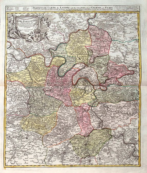
Title:
“Agri Parisiensis. . .”
Map Maker:
Johann Baptist Homann
A detailed map of Île-de-France centered on Paris.... (full text available to subscribers)
| Item Detail |
| |
| |
MapMaker: |
Johann Baptist Homann
|
|
| |
| |
Subject: |
France |
|
| |
Period/Size: |
c. 1716 / 19.0" x 22.6" (48.2 x 57.5 cm)
|
|
| |
Color: |
Colored
|
|
| |
Condition: |
In good and decorative condition. (condition help) |
|
| |
Source: |
|
|
| |
References: |
|
|
| |
|
|
| Sales Information |
| |
| |
Price: |
|
|
| |
| |
Offered by: |
Paulus Swaen Old Maps & Prints |
|
| |
Catalog: |
October 15, 2019 Internet Auction (9473) |
|
| |
Lot/Item #: |
83205 |
|
| |
| |
Date: |
09/2019
|
|
| |
| |
|
Antique Maps - Valuation and Pricing, Descriptions, Resources |
|
Home |
Information |
Search |
Register |
Contact Us |
Site Map
Americana Exchange, Inc. © 1999 - 2024 Americana Exchange, Inc.. All rights reserved.
OldMaps.com, the OldMaps.com logo and
AMPR are service marks or registered service marks of Americana Exchange, Inc..
|