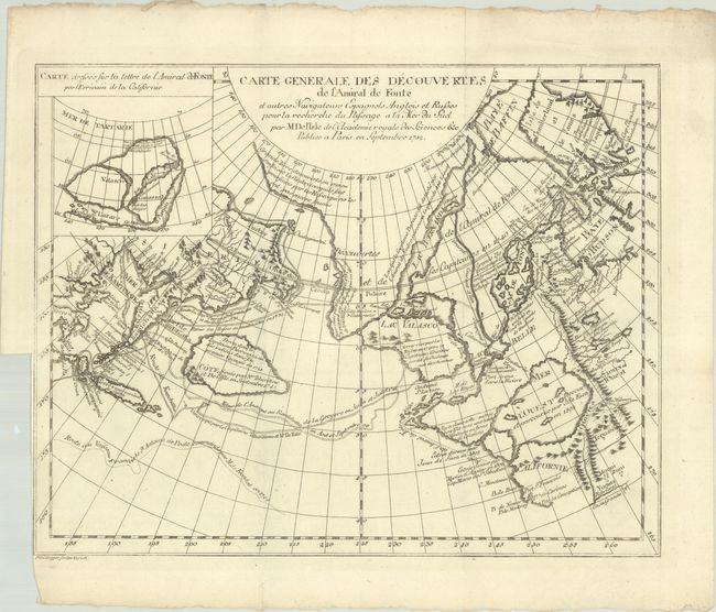
Title:
“Carte Generale des Decouvertes de l'Amiral de Fonte et Autres Navigateurs Espagnols Anglois et Russes pour la Recherche du Passage a la Mer du Sud...”
Map Maker:
Didier Robert de Vaugondy
This is one of the more remarkable combinations of... (full text available to subscribers)
| Item Detail |
| |
| |
MapMaker: |
Didier Robert de Vaugondy
|
|
| |
| |
Subject: |
North Pacific Ocean |
|
| |
Period/Size: |
1755 / 11.6" x 14.8" (29.5 x 37.6 cm)
|
|
| |
Color: |
Black & White
|
|
| |
Condition: |
(A) Issued folding with a binding trim in the left blank margin. (condition help) |
|
| |
Source: |
Diderot's Encyclopedia (Supplement) |
|
| |
References: |
Hayes, pp. 26-27; Pedley #454. |
|
| |
|
|
| Sales Information |
| |
| |
Price: |
|
|
| |
| |
Offered by: |
Old World Auctions |
|
| |
Catalog: |
Auction No. 191 - Antique Maps, Charts, Atlases & Globes (9561) |
|
| |
Lot/Item #: |
766 |
|
| |
| |
Date: |
02/2023
|
|
| |
| |
|
Antique Maps - Valuation and Pricing, Descriptions, Resources |
|
Home |
Information |
Search |
Register |
Contact Us |
Site Map
Americana Exchange, Inc. © 1999 - 2024 Americana Exchange, Inc.. All rights reserved.
OldMaps.com, the OldMaps.com logo and
AMPR are service marks or registered service marks of Americana Exchange, Inc..
|