Title:
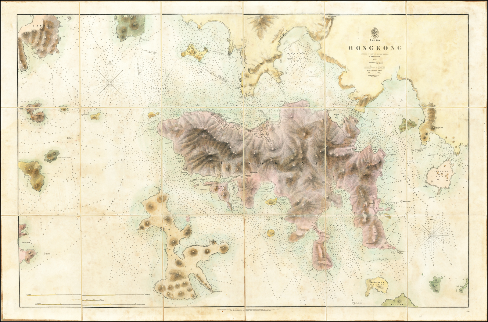
“Hong Kong surveyed by Captn. Sir Edward Belcher, in H.M.S. Sulphur 1841”
Map Maker:
British Admiralty
The First Printed Map of Hong Kong
Early edition ... (full text available to subscribers)
| Item Detail |
| |
| |
MapMaker: |
British Admiralty
|
|
| |
| |
Subject: |
China / |
|
| |
Period/Size: |
1843 (1857) / 24.0" x 36.0" (61.0 x 91.5 cm)
|
|
| |
Color: |
Colored
|
|
| |
Condition: |
VG / Dissected and laid on linen, with pastedown titlle (condition help) |
|
| |
Source: |
|
|
| |
References: |
|
|
| |
|
|
| Sales Information |
| |
| |
Price: |
|
|
| |
| |
Offered by: |
Barry L. Ruderman Antique Maps Inc. |
|
| |
Catalog: |
Recently Added - July 2021 (9521) |
|
| |
Lot/Item #: |
61663 |
|
| |
| |
Date: |
07/2021
|
|
| |
| |
|
Antique Maps - Valuation and Pricing, Descriptions, Resources |
|
Home |
Information |
Search |
Register |
Contact Us |
Site Map
Americana Exchange, Inc. © 1999 - 2024 Americana Exchange, Inc.. All rights reserved.
OldMaps.com, the OldMaps.com logo and
AMPR are service marks or registered service marks of Americana Exchange, Inc..
|