Title:
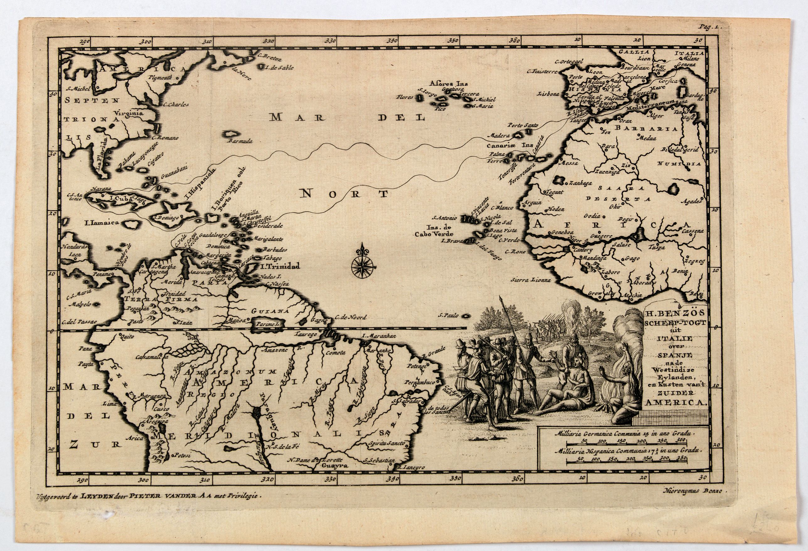
“H. Benzos Scheep-togt uit Italie over Spanje na de Westindize Eylanden, en Kusten van't Zuider America.”
Map Maker:
VAN DER AA, Pieter.
A delightful map of the Atlantic Ocean highlightin... (full text available to subscribers)
| Item Detail |
| |
| |
MapMaker: |
VAN DER AA, Pieter.
|
|
| |
| |
Subject: |
Caribbean |
|
| |
Period/Size: |
ca 1710 / 8.9" x 5.9" (22.5 x 15.1 cm)
|
|
| |
Color: |
Colored
|
|
| |
Condition: |
In excellent condition. Folds as issued, slight loss to lower left margin, light paper creasing, Lovely dark impression. (condition help) |
|
| |
Source: |
|
|
| |
References: |
|
|
| |
|
|
| Sales Information |
| |
| |
Price: |
|
|
| |
| |
Offered by: |
Paulus Swaen Old Maps & Prints |
|
| |
Catalog: |
May 2020 Internet Auction (9517) |
|
| |
Lot/Item #: |
45715 |
|
| |
| |
Date: |
05/2020
|
|
| |
| |
|
Antique Maps - Valuation and Pricing, Descriptions, Resources |
|
Home |
Information |
Search |
Register |
Contact Us |
Site Map
Americana Exchange, Inc. © 1999 - 2024 Americana Exchange, Inc.. All rights reserved.
OldMaps.com, the OldMaps.com logo and
AMPR are service marks or registered service marks of Americana Exchange, Inc..
|