Title:
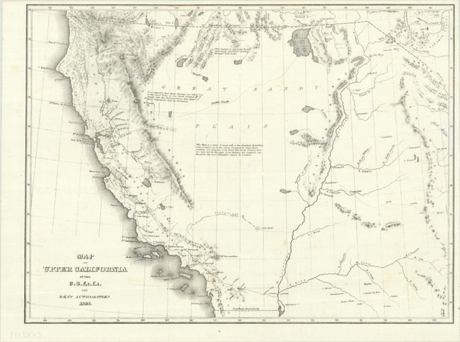
“Map of Upper California by the U.S. Ex. Ex. and Best Authorities”
Map Maker:
Charles Wilkes
This crisply drawn map covers all the American Wes... (full text available to subscribers)
| Item Detail |
| |
| |
MapMaker: |
Charles Wilkes
|
|
| |
| |
Subject: |
Western United States |
|
| |
Period/Size: |
1841 / 8.5" x 11.3" (21.6 x 28.7 cm)
|
|
| |
Color: |
Black & White
|
|
| |
Condition: |
(A) Issued folding on a bright sheet with a few faint spots. (condition help) |
|
| |
Source: |
Narrative of the United States Exploring Expedition |
|
| |
References: |
Wheat (TMW) #458; Wheat (Gold) #23. |
|
| |
|
|
| Sales Information |
| |
| |
Price: |
|
|
| |
| |
Offered by: |
Old World Auctions |
|
| |
Catalog: |
Auction No. 193 - Antique Maps, Charts, Atlases & Globes (9567) |
|
| |
Lot/Item #: |
199 |
|
| |
| |
Date: |
07/2023
|
|
| |
| |
|
Antique Maps - Valuation and Pricing, Descriptions, Resources |
|
Home |
Information |
Search |
Register |
Contact Us |
Site Map
Americana Exchange, Inc. © 1999 - 2024 Americana Exchange, Inc.. All rights reserved.
OldMaps.com, the OldMaps.com logo and
AMPR are service marks or registered service marks of Americana Exchange, Inc..
|