Title:
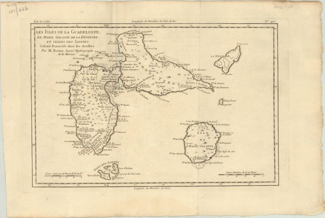
“Les Isles de la Guadeloupe, de Marie Galante de la Desirade, et Celles des Saintes: Colonie Francoise dans les Antilles”
Map Maker:
Rigobert Bonne
This map of the island group features good detail,... (full text available to subscribers)
| Item Detail |
| |
| |
MapMaker: |
Rigobert Bonne
|
|
| |
| |
Subject: |
Guadeloupe |
|
| |
Period/Size: |
1779 / 8.2" x 12.4" (20.9 x 31.5 cm)
|
|
| |
Color: |
Black & White
|
|
| |
Condition: |
(B+) A nice impression issued folding on a sturdy watermarked sheet. There is minor toning and offsetting. (condition help) |
|
| |
Source: |
|
|
| |
References: |
|
|
| |
|
|
| Sales Information |
| |
| |
Price: |
|
|
| |
| |
Offered by: |
Old World Auctions |
|
| |
Catalog: |
Auction No. 191 - Antique Maps, Charts, Atlases & Globes (9561) |
|
| |
Lot/Item #: |
394 |
|
| |
| |
Date: |
02/2023
|
|
| |
| |
|
Antique Maps - Valuation and Pricing, Descriptions, Resources |
|
Home |
Information |
Search |
Register |
Contact Us |
Site Map
Americana Exchange, Inc. © 1999 - 2024 Americana Exchange, Inc.. All rights reserved.
OldMaps.com, the OldMaps.com logo and
AMPR are service marks or registered service marks of Americana Exchange, Inc..
|