Title:
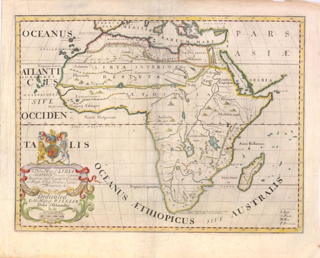
“A New Map of Libya or old Africk Shewing its general Divisions, most remarkable Countries or People, Cities, Townes, Rivers, Mountains, &c.”
Map Maker:
Edward Wells
Wells' atlas contained two maps of each region - o... (full text available to subscribers)
| Item Detail |
| |
| |
MapMaker: |
Edward Wells
|
|
| |
| |
Subject: |
Africa |
|
| |
Period/Size: |
1700 / 14.6" x 19.4" (37.1 x 49.3 cm)
|
|
| |
Color: |
Colored
|
|
| |
Condition: |
Some light soiling along centerfold and a few creases that have been pressed. (condition help) |
|
| |
Source: |
A New Sett of Maps Both of Antient and Present Geography |
|
| |
References: |
Norwich #60. |
|
| |
|
|
| Sales Information |
| |
| |
Price: |
|
|
| |
| |
Offered by: |
Old World Auctions |
|
| |
Catalog: |
Auction No. 137 - Antique Maps, Charts, Atlases & Globes (7408) |
|
| |
Lot/Item #: |
788 |
|
| |
| |
Date: |
09/2011
|
|
| |
| |
|
Antique Maps - Valuation and Pricing, Descriptions, Resources |
|
Home |
Information |
Search |
Register |
Contact Us |
Site Map
Americana Exchange, Inc. © 1999 - 2024 Americana Exchange, Inc.. All rights reserved.
OldMaps.com, the OldMaps.com logo and
AMPR are service marks or registered service marks of Americana Exchange, Inc..
|