| Item Detail |
| |
| |
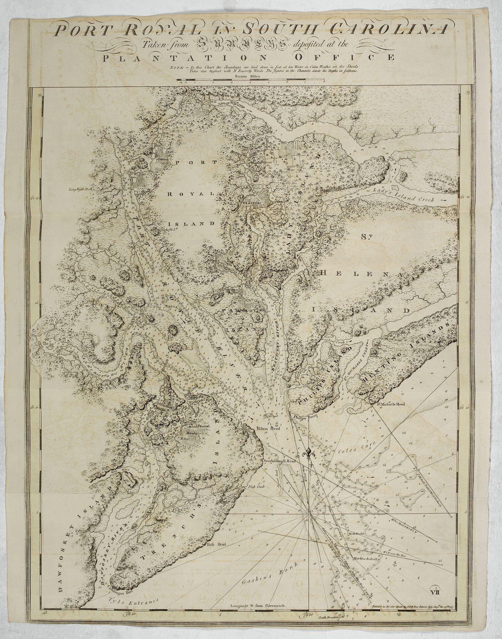
MapMaker: |
Joseph Frederick Wallet Des Barres
|
|
| |
| |
Subject: |
South Carolina |
|
| |
Period/Size: |
1777 / 28.7" x 23.8" (72.9 x 60.5 cm)
|
|
| |
Color: |
Black & White
|
|
| |
Condition: |
Paper slightly age-toned and slightly spotted. Short upper and lower margin as usual, folds as issued, on JBATES water marked paper. Yellow border. Dark impression on thick paper. Some very minor offsetting due to oxidation of ink. (condition help) |
|
| |
Source: |
Atlantic Neptune |
|
| |
References: |
|
|
| |
|
|
| Sales Information |
| |
| |
Price: |
|
|
| |
| |
Offered by: |
Paulus Swaen Old Maps & Prints |
|
| |
Catalog: |
October 15, 2019 Internet Auction (9473) |
|
| |
Lot/Item #: |
44821 |
|
| |
| |
Date: |
10/2019
|
|
| |
| |
|