| Item Detail |
| |
| |
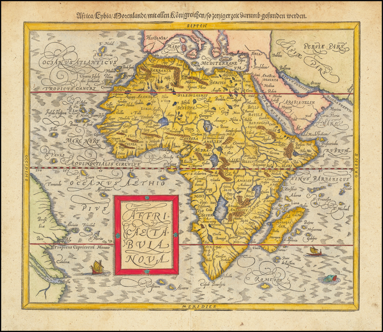
MapMaker: |
Sebastian Munster
|
|
| |
| |
Subject: |
Africa |
|
| |
Period/Size: |
c. 1588 / 12.5" x 14.0" (31.8 x 35.6 cm)
|
|
| |
Color: |
Colored
|
|
| |
Condition: |
VG (condition help) |
|
| |
Source: |
|
|
| |
References: |
Richard L. Betz, The Mapping of Africa: A Cartobibliography of Printed Maps of the African Continent to 1700 (Hes & de Graaf Publishers BV, 2007), map 21; Oscar I. Norwich with Jeffrey C. Stone and Pam Kolbe, Norwich’s Maps of Africa: An illustrated and a |
|
| |
|
|
| Sales Information |
| |
| |
Price: |
|
|
| |
| |
Offered by: |
Barry L. Ruderman Antique Maps Inc. |
|
| |
Catalog: |
Recently Added - September 2020 (9488) |
|
| |
Lot/Item #: |
68682 |
|
| |
| |
Date: |
09/2020
|
|
| |
| |
|