Title:
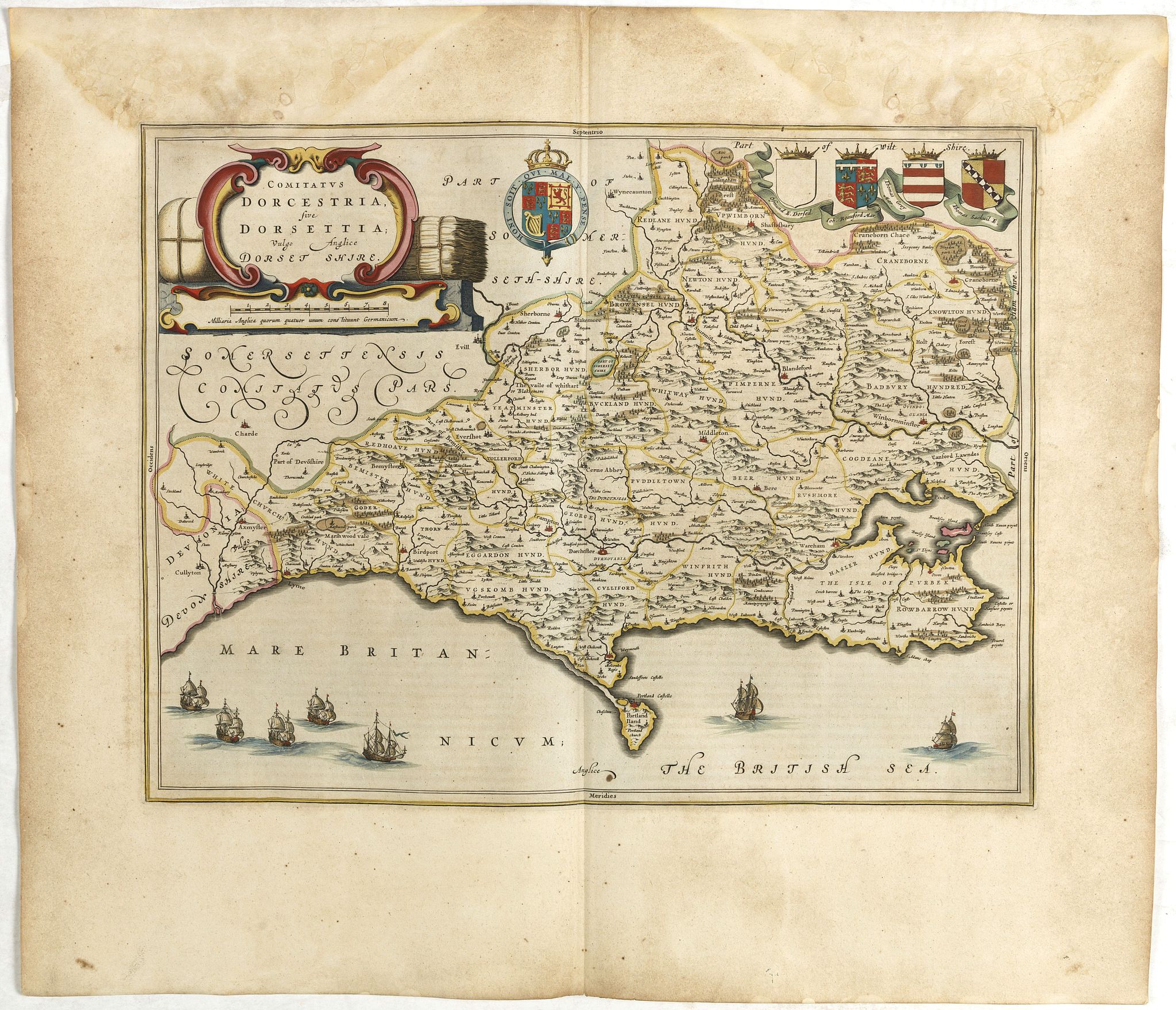
“Comitatus Dorcestria, sive Dorsettia, Vulgo Anglice Dorset shire.”
Map Maker:
BLAEU, J.
Double-page map of Dorsetshire county with decorat... (full text available to subscribers)
| Item Detail |
| |
| |
MapMaker: |
BLAEU, J.
|
|
| |
| |
Subject: |
British counties |
|
| |
Period/Size: |
ca. 1645 / 19.7" x 16.1" (50.1 x 41.0 cm)
|
|
| |
Color: |
Colored
|
|
| |
Condition: |
Some light marginal water marks. Else in good condition. (condition help) |
|
| |
Source: |
|
|
| |
References: |
|
|
| |
|
|
| Sales Information |
| |
| |
Price: |
|
|
| |
| |
Offered by: |
Paulus Swaen Old Maps & Prints |
|
| |
Catalog: |
February 2020 Internet Auction (9513) |
|
| |
Lot/Item #: |
42811 |
|
| |
| |
Date: |
02/2021
|
|
| |
| |
|
Antique Maps - Valuation and Pricing, Descriptions, Resources |
|
Home |
Information |
Search |
Register |
Contact Us |
Site Map
Americana Exchange, Inc. © 1999 - 2024 Americana Exchange, Inc.. All rights reserved.
OldMaps.com, the OldMaps.com logo and
AMPR are service marks or registered service marks of Americana Exchange, Inc..
|