Title:
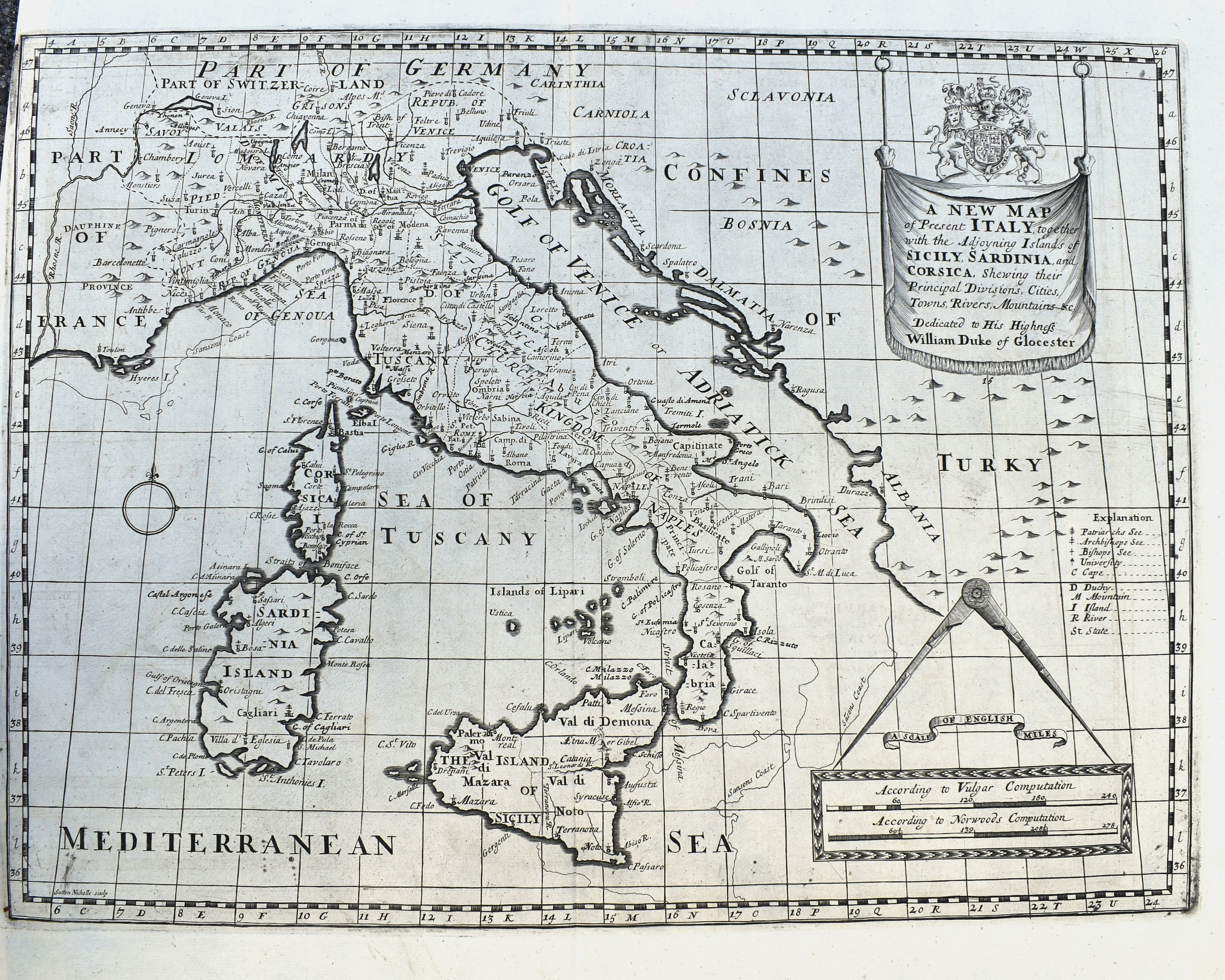
“A New Map of Present Italy, together with the Adjoining Islands of Sicily, Sardinia, and Corsica. . .”
Map Maker:
WELLS, E.
A scarce copper engraved map of Italy with many pl... (full text available to subscribers)
| Item Detail |
| |
| |
MapMaker: |
WELLS, E.
|
|
| |
| |
Subject: |
Italy |
|
| |
Period/Size: |
ca 1701-14 / 19.5" x 14.7" (49.5 x 37.4 cm)
|
|
| |
Color: |
Unknown
|
|
| |
Condition: |
A very good print on hand-laid paper with two large real watermarks. Faint toning and soiling. Short margin to the left side. (condition help) |
|
| |
Source: |
|
|
| |
References: |
|
|
| |
|
|
| Sales Information |
| |
| |
Price: |
|
|
| |
| |
Offered by: |
Paulus Swaen Old Maps & Prints |
|
| |
Catalog: |
February 2020 Internet Auction (9513) |
|
| |
Lot/Item #: |
83717 |
|
| |
| |
Date: |
02/2021
|
|
| |
| |
|
Antique Maps - Valuation and Pricing, Descriptions, Resources |
|
Home |
Information |
Search |
Register |
Contact Us |
Site Map
Americana Exchange, Inc. © 1999 - 2024 Americana Exchange, Inc.. All rights reserved.
OldMaps.com, the OldMaps.com logo and
AMPR are service marks or registered service marks of Americana Exchange, Inc..
|