Title:
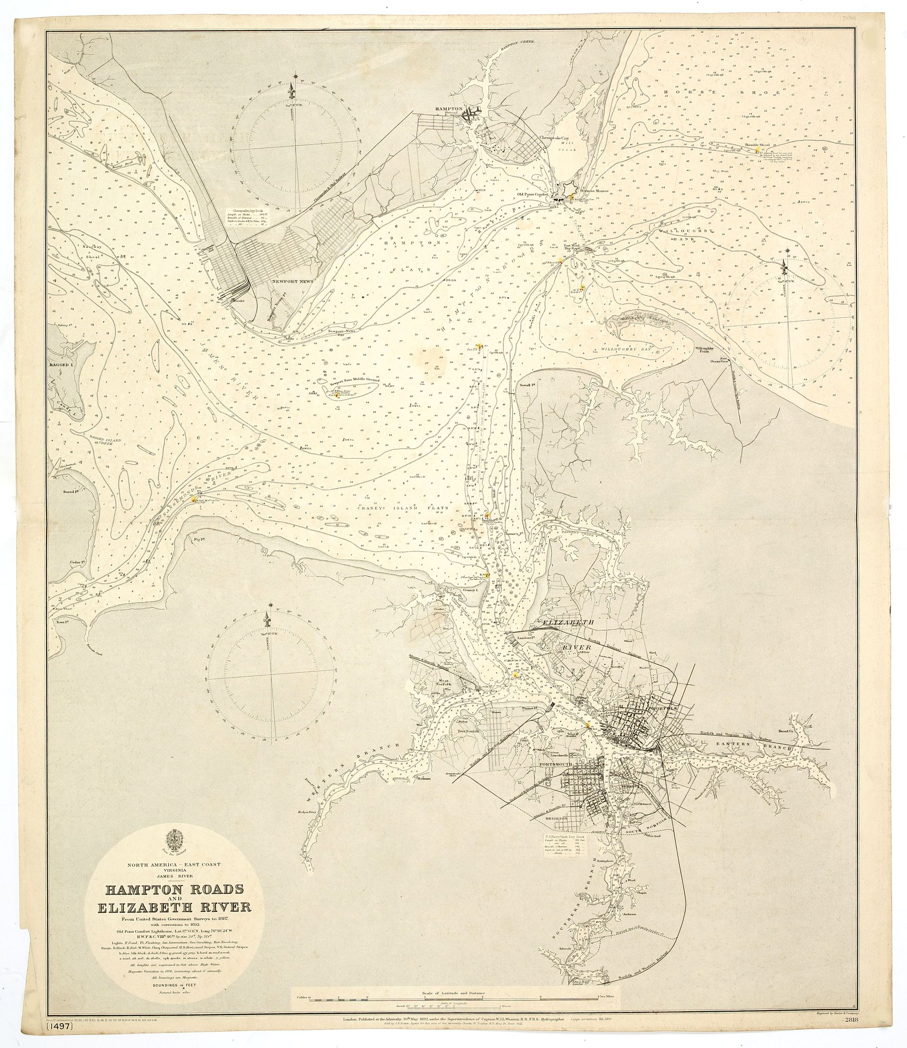
“Hampton road and Elizabeth River. . .”
Map Maker:
BRITISH ADMIRALTY
A fine Hydrographic Office chart no. 2818, figurin... (full text available to subscribers)
| Item Detail |
| |
| |
MapMaker: |
BRITISH ADMIRALTY
|
|
| |
| |
Subject: |
Virginia/ Maryland/ Carolina / Georgia |
|
| |
Period/Size: |
1892- 1900 / 25.2" x 30.7" (64.0 x 78.0 cm)
|
|
| |
Color: |
Colored
|
|
| |
Condition: |
Paper slightly age-toned as usual. Lights coloured. Very good condition. (condition help) |
|
| |
Source: |
|
|
| |
References: |
|
|
| |
|
|
| Sales Information |
| |
| |
Price: |
|
|
| |
| |
Offered by: |
Paulus Swaen Old Maps & Prints |
|
| |
Catalog: |
April 2020 Internet Auction (9516) |
|
| |
Lot/Item #: |
43835 |
|
| |
| |
Date: |
04/2020
|
|
| |
| |
|
Antique Maps - Valuation and Pricing, Descriptions, Resources |
|
Home |
Information |
Search |
Register |
Contact Us |
Site Map
Americana Exchange, Inc. © 1999 - 2024 Americana Exchange, Inc.. All rights reserved.
OldMaps.com, the OldMaps.com logo and
AMPR are service marks or registered service marks of Americana Exchange, Inc..
|