Title:
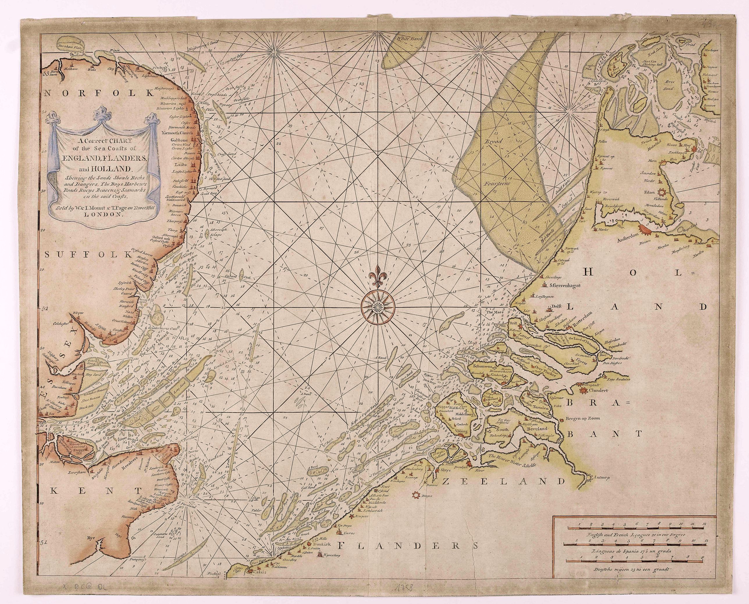
“A Correct Chart Of The Sea Coasts Of England, Flanders And Holland Shewing The Sands Shoals Rocks And Dangers, The Bays Harbours Roads Buoys Beacons & Seamarks On The Said Coasts.”
Map Maker:
MOUNT, W. / PAGE, T.
Mount & Page's chart of the Channel and contiguous... (full text available to subscribers)
| Item Detail |
| |
| |
MapMaker: |
MOUNT, W. / PAGE, T.
|
|
| |
| |
Subject: |
Netherlands |
|
| |
Period/Size: |
ca. 1750 / 21.3" x 17.1" (54.0 x 43.6 cm)
|
|
| |
Color: |
Colored
|
|
| |
Condition: |
Tears in lower center. Paper slightly browned. (condition help) |
|
| |
Source: |
|
|
| |
References: |
|
|
| |
|
|
| Sales Information |
| |
| |
Price: |
|
|
| |
| |
Offered by: |
Paulus Swaen Old Maps & Prints |
|
| |
Catalog: |
May 2020 Internet Auction (9517) |
|
| |
Lot/Item #: |
45768 |
|
| |
| |
Date: |
05/2020
|
|
| |
| |
|
Antique Maps - Valuation and Pricing, Descriptions, Resources |
|
Home |
Information |
Search |
Register |
Contact Us |
Site Map
Americana Exchange, Inc. © 1999 - 2024 Americana Exchange, Inc.. All rights reserved.
OldMaps.com, the OldMaps.com logo and
AMPR are service marks or registered service marks of Americana Exchange, Inc..
|