Title:
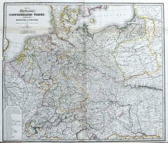
“Map of the Germanic Confederated States, including the Kingdom of Prussia, as Settled by the Act of Congress at Vienna, June 9th 1815.”
Map Maker:
WYLD, J.
Large and detailed map of central Europe. From Fra... (full text available to subscribers)
| Item Detail |
| |
| |
MapMaker: |
WYLD, J.
|
|
| |
| |
Subject: |
Prussia |
|
| |
Period/Size: |
c1840 / 29.7" x 25.1" (75.4 x 63.7 cm)
|
|
| |
Color: |
Colored
|
|
| |
Condition: |
Good dark print on heavy paper. Two sheets joined together as issued. Some light toning and soiling. Bottom margin short and with rough edges. (condition help) |
|
| |
Source: |
|
|
| |
References: |
|
|
| |
|
|
| Sales Information |
| |
| |
Price: |
|
|
| |
| |
Offered by: |
Paulus Swaen Old Maps & Prints |
|
| |
Catalog: |
September 2020 Internet Auction (9519) |
|
| |
Lot/Item #: |
84391 |
|
| |
| |
Date: |
09/2020
|
|
| |
| |
|
Antique Maps - Valuation and Pricing, Descriptions, Resources |
|
Home |
Information |
Search |
Register |
Contact Us |
Site Map
Americana Exchange, Inc. © 1999 - 2024 Americana Exchange, Inc.. All rights reserved.
OldMaps.com, the OldMaps.com logo and
AMPR are service marks or registered service marks of Americana Exchange, Inc..
|