Title:
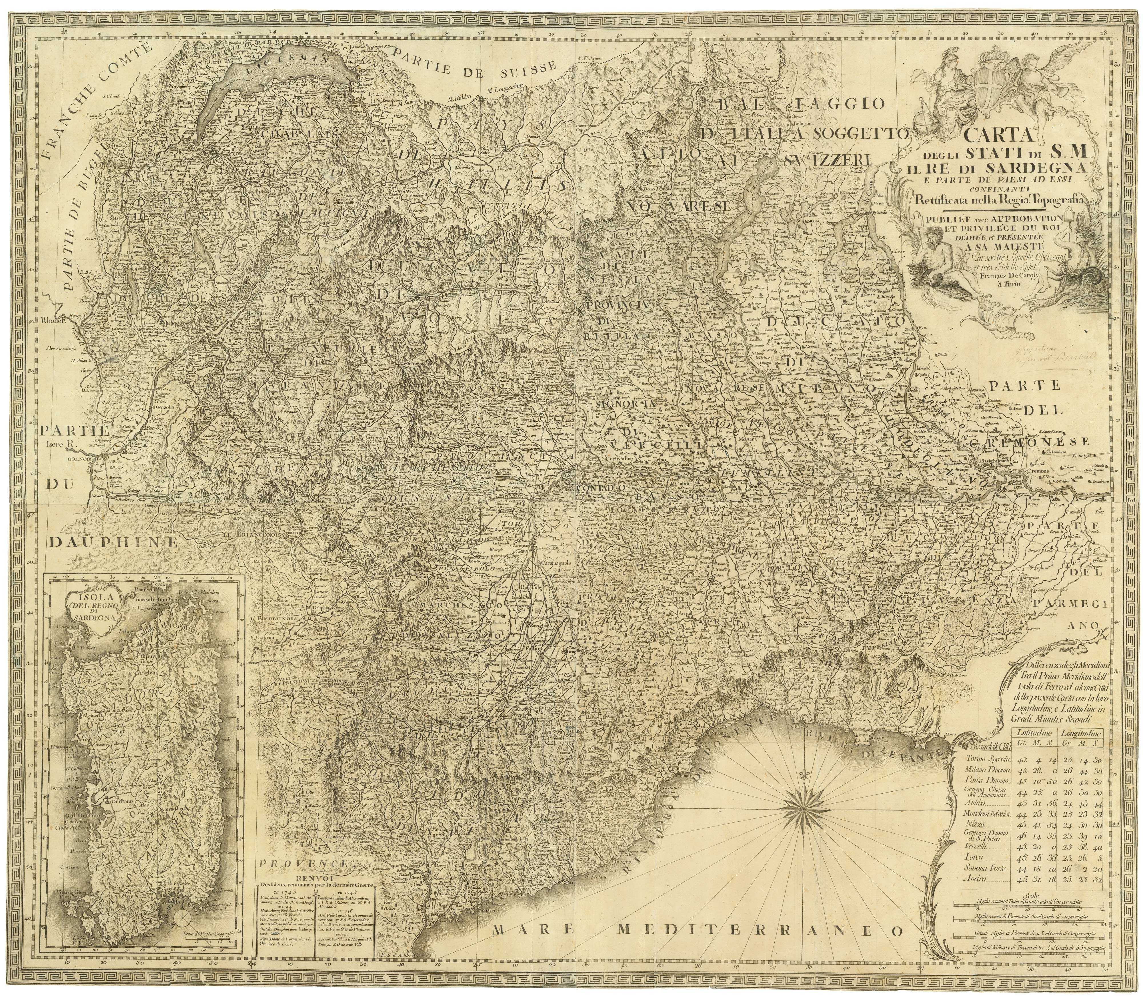
“Carta degli stati di S.M. il Re di Sardegna e parte de paesi ad essi confinanti rettificata nella Regia Topografia.”
Map Maker:
CAROLI, Francesco de.
An 18th century wall map of the Kingdom of Sardini... (full text available to subscribers)
| Item Detail |
| |
| |
MapMaker: |
CAROLI, Francesco de.
|
|
| |
| |
Subject: |
Sardinia |
|
| |
Period/Size: |
c. 1779 / 33.9" x 29.3" (86.0 x 74.5 cm)
|
|
| |
Color: |
Unknown
|
|
| |
Condition: |
Trimmed to printed border, a few small repairs, old ink mss. under cartouche. (condition help) |
|
| |
Source: |
|
|
| |
References: |
|
|
| |
|
|
| Sales Information |
| |
| |
Price: |
|
|
| |
| |
Offered by: |
Altea Gallery |
|
| |
Catalog: |
New Additions July 2021 (9523) |
|
| |
Lot/Item #: |
21921 |
|
| |
| |
Date: |
07/2021
|
|
| |
| |
|
Antique Maps - Valuation and Pricing, Descriptions, Resources |
|
Home |
Information |
Search |
Register |
Contact Us |
Site Map
Americana Exchange, Inc. © 1999 - 2024 Americana Exchange, Inc.. All rights reserved.
OldMaps.com, the OldMaps.com logo and
AMPR are service marks or registered service marks of Americana Exchange, Inc..
|