| Item Detail |
| |
| |
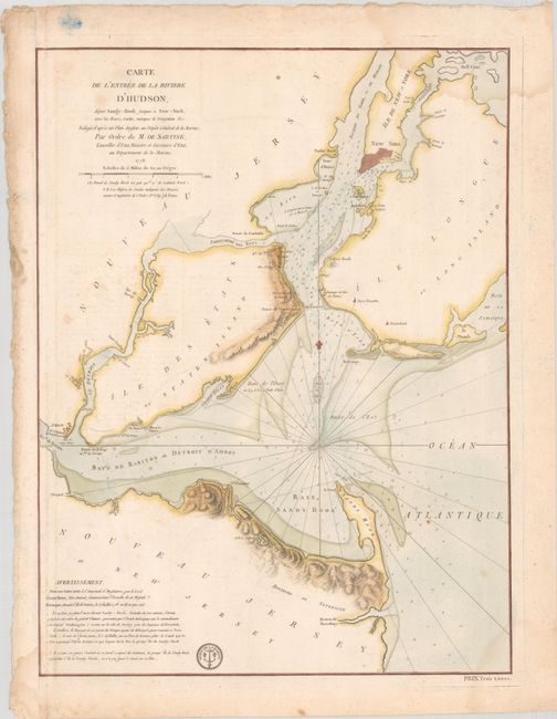
MapMaker: |
Sartine
|
|
| |
| |
Subject: |
Colonial New York Harbor, Revolutionary War |
|
| |
Period/Size: |
1778 / 23.2" x 17.5" (59.0 x 44.5 cm)
|
|
| |
Color: |
Colored
|
|
| |
Condition: |
(B) On watermarked paper with light dampstaining in the corners, scattered foxing, and minor offsetting. The sheet has been remargined at left, with tape on verso. (condition help) |
|
| |
Source: |
|
|
| |
References: |
|
|
| |
|
|
| Sales Information |
| |
| |
Price: |
|
|
| |
| |
Offered by: |
Old World Auctions |
|
| |
Catalog: |
Auction No. 191 - Antique Maps, Charts, Atlases & Globes (9561) |
|
| |
Lot/Item #: |
306 |
|
| |
| |
Date: |
02/2023
|
|
| |
| |
|