| Item Detail |
| |
| |
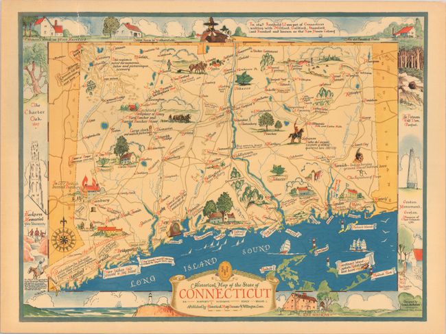
MapMaker: |
Historical Map Bureau
|
|
| |
| |
Subject: |
Connecticut |
|
| |
Period/Size: |
1937 / 16.8" x 22.0" (42.7 x 55.9 cm)
|
|
| |
Color: |
Colored
|
|
| |
Condition: |
(B+) A colorful example with light toning along the sheet edges and several short edge tears that have been repaired with archival tape on verso, including one that enters 1.5" into image at top. (condition help) |
|
| |
Source: |
|
|
| |
References: |
Rumsey #8949. |
|
| |
|
|
| Sales Information |
| |
| |
Price: |
|
|
| |
| |
Offered by: |
Old World Auctions |
|
| |
Catalog: |
Auction No. 191 - Antique Maps, Charts, Atlases & Globes (9561) |
|
| |
Lot/Item #: |
263 |
|
| |
| |
Date: |
02/2023
|
|
| |
| |
|