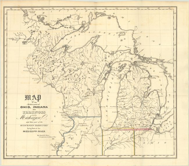
Title:
“Map of the Northern Parts of Ohio, Indiana and Illinois with Michigan, and That Part of the Ouisconsin Territory Lying East of the Mississippi River”
Map Maker:
David H. Burr
This map covers the region from northern Ohio west... (full text available to subscribers)
| Item Detail |
| |
| |
MapMaker: |
David H. Burr
|
|
| |
| |
Subject: |
Upper Midwestern United States |
|
| |
Period/Size: |
1836 / 13.1" x 14.9" (33.3 x 37.9 cm)
|
|
| |
Color: |
Colored
|
|
| |
Condition: |
(B+) Issued folding with faint offsetting and a 1.75" edge tear at left that has been archivally repaired on verso. (condition help) |
|
| |
Source: |
|
|
| |
References: |
Claussen & Friis #144; Karpinski #135. |
|
| |
|
|
| Sales Information |
| |
| |
Price: |
|
|
| |
| |
Offered by: |
Old World Auctions |
|
| |
Catalog: |
Auction No. 191 - Antique Maps, Charts, Atlases & Globes (9561) |
|
| |
Lot/Item #: |
207 |
|
| |
| |
Date: |
02/2023
|
|
| |
| |
|
Antique Maps - Valuation and Pricing, Descriptions, Resources |
|
Home |
Information |
Search |
Register |
Contact Us |
Site Map
Americana Exchange, Inc. © 1999 - 2024 Americana Exchange, Inc.. All rights reserved.
OldMaps.com, the OldMaps.com logo and
AMPR are service marks or registered service marks of Americana Exchange, Inc..
|