Title:
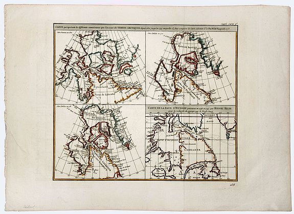
“ Carte qui Represente les Differentes Connoissances que l'on a eues des Terres Arctiques depuis 1650 jusqu'en 1747 �”
Map Maker:
Robert de Vaugondy [Family]
A beautiful set of four maps of the Hudson, Button... (full text available to subscribers)
| Item Detail |
| |
| |
MapMaker: |
Robert de Vaugondy [Family]
|
|
| |
| |
Subject: |
Canada New data: Canada |
|
| |
Period/Size: |
1772 / 14.8" x 11.5" (37.6 x 29.3 cm)
|
|
| |
Color: |
Colored
|
|
| |
Condition: |
In very good condition. One margin uneven. Generous margins. (condition help) |
|
| |
Source: |
|
|
| |
References: |
|
|
| |
|
|
| Sales Information |
| |
| |
Price: |
|
|
| |
| |
Offered by: |
Paulus Swaen Old Maps & Prints |
|
| |
Catalog: |
October 15, 2019 Internet Auction (9473) |
|
| |
Lot/Item #: |
83199 |
|
| |
| |
Date: |
10/2019
|
|
| |
| |
|
Antique Maps - Valuation and Pricing, Descriptions, Resources |
|
Home |
Information |
Search |
Register |
Contact Us |
Site Map
Americana Exchange, Inc. © 1999 - 2024 Americana Exchange, Inc.. All rights reserved.
OldMaps.com, the OldMaps.com logo and
AMPR are service marks or registered service marks of Americana Exchange, Inc..
|