| Item Detail |
| |
| |
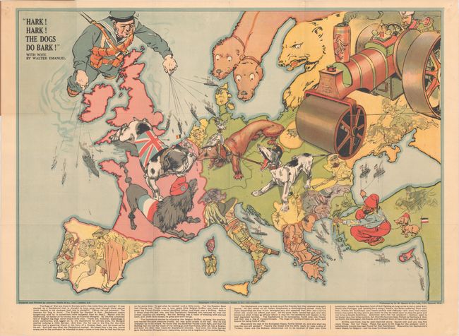
MapMaker: |
George Washington Bacon & Company
|
|
| |
| |
Subject: |
Europe, WWI |
|
| |
Period/Size: |
1914 / 19.0" x 27.6" (48.3 x 70.1 cm)
|
|
| |
Color: |
Colored
|
|
| |
Condition: |
(B+) A bright and clean example, issued folding with several short fold separations and one separation that enters 1.5" into image at top, adjacent to Scandinavia. The covers are very lightly worn with a few short tears along the spine. (condition help) |
|
| |
Source: |
|
|
| |
References: |
|
|
| |
|
|
| Sales Information |
| |
| |
Price: |
|
|
| |
| |
Offered by: |
Old World Auctions |
|
| |
Catalog: |
Auction No. 172 - Antique Maps, Charts, Atlases & Globes (9470) |
|
| |
Lot/Item #: |
384 |
|
| |
| |
Date: |
04/2019
|
|
| |
| |
|