Title:
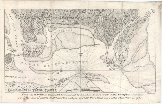
“Plan du Havre de Charleston, Montrant la Disposition de la Flotte Britannique, Commandee par le Vice-Amiral Marie Arbuthnot, a l'Attaque du Fort Moultrie dans l'Isle Sullivan, en 1780”
Map Maker:
David Ramsay
This rare, small map of the Siege of Charleston is... (full text available to subscribers)
| Item Detail |
| |
| |
MapMaker: |
David Ramsay
|
|
| |
| |
Subject: |
South Carolina, Revolutionary War |
|
| |
Period/Size: |
1787 / 6.9" x 11.5" (17.6 x 29.3 cm)
|
|
| |
Color: |
Black & White
|
|
| |
Condition: |
(B+) Issued folding on watermarked paper with faint offsetting, a few minor misfolds, and a clean 2.5" tear at lower right that has been professionally repaired. Minor soiling in blank margins. (condition help) |
|
| |
Source: |
Histoire de la Revolution d'Amerique, par Rapport a la Caroline Meridionale |
|
| |
References: |
Nebenzahl (Biblio) #85. |
|
| |
|
|
| Sales Information |
| |
| |
Price: |
|
|
| |
| |
Offered by: |
Old World Auctions |
|
| |
Catalog: |
Auction No. 148 - Antique Maps, Charts, Atlases & Globes (9227) |
|
| |
Lot/Item #: |
310 |
|
| |
| |
Date: |
02/2014
|
|
| |
| |
|
Antique Maps - Valuation and Pricing, Descriptions, Resources |
|
Home |
Information |
Search |
Register |
Contact Us |
Site Map
Americana Exchange, Inc. © 1999 - 2024 Americana Exchange, Inc.. All rights reserved.
OldMaps.com, the OldMaps.com logo and
AMPR are service marks or registered service marks of Americana Exchange, Inc..
|