Title:
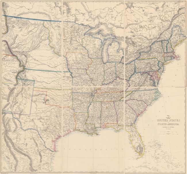
“United States of North America (Eastern & Central)”
Map Maker:
Theodor Ettling
This six-sheet map shows the westward growth of th... (full text available to subscribers)
| Item Detail |
| |
| |
MapMaker: |
Theodor Ettling
|
|
| |
| |
Subject: |
United States |
|
| |
Period/Size: |
1860 / 16.8" x 12.0" (42.7 x 30.5 cm)
|
|
| |
Color: |
Colored
|
|
| |
Condition: |
(A) A clean and bright example with original outline color. There are small stains in Alabama and northeast Canada. (condition help) |
|
| |
Source: |
Weekly Dispatch Atlas |
|
| |
References: |
|
|
| |
|
|
| Sales Information |
| |
| |
Price: |
|
|
| |
| |
Offered by: |
Old World Auctions |
|
| |
Catalog: |
Auction No. 156 - Antique Maps, Charts, Atlases & Globes (9289) |
|
| |
Lot/Item #: |
147 |
|
| |
| |
Date: |
02/2016
|
|
| |
| |
|
Antique Maps - Valuation and Pricing, Descriptions, Resources |
|
Home |
Information |
Search |
Register |
Contact Us |
Site Map
Americana Exchange, Inc. © 1999 - 2024 Americana Exchange, Inc.. All rights reserved.
OldMaps.com, the OldMaps.com logo and
AMPR are service marks or registered service marks of Americana Exchange, Inc..
|