Title:
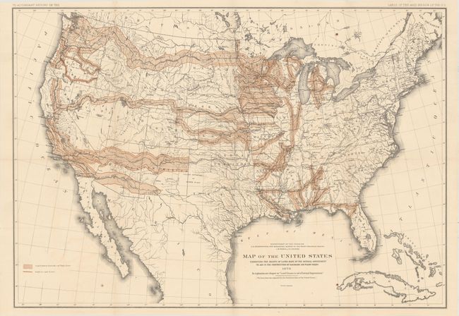
“Map of the United States Exhibiting the Grants of Lands Made by the General Government to Aid in the Construction of Railroads and Wagon Roads”
Map Maker:
U.S. Department of Interior
Public Domain Land, the largest land give-away eve... (full text available to subscribers)
| Item Detail |
| |
| |
MapMaker: |
U.S. Department of Interior
|
|
| |
| |
Subject: |
United States |
|
| |
Period/Size: |
1878 / 19.7" x 28.3" (50.1 x 71.9 cm)
|
|
| |
Color: |
Colored
|
|
| |
Condition: |
(B+) Issued folding with faint color offsetting and a few spots of foxing. There are a few tiny edge tears confined to the top blank margin. (condition help) |
|
| |
Source: |
Report on the Lands of the Arid Region of the U.S. |
|
| |
References: |
|
|
| |
|
|
| Sales Information |
| |
| |
Price: |
|
|
| |
| |
Offered by: |
Old World Auctions |
|
| |
Catalog: |
Auction No. 161 - Antique Maps, Charts, Atlases & Globes (9343) |
|
| |
Lot/Item #: |
159 |
|
| |
| |
Date: |
02/2017
|
|
| |
| |
|
Antique Maps - Valuation and Pricing, Descriptions, Resources |
|
Home |
Information |
Search |
Register |
Contact Us |
Site Map
Americana Exchange, Inc. © 1999 - 2024 Americana Exchange, Inc.. All rights reserved.
OldMaps.com, the OldMaps.com logo and
AMPR are service marks or registered service marks of Americana Exchange, Inc..
|