| Item Detail |
| |
| |
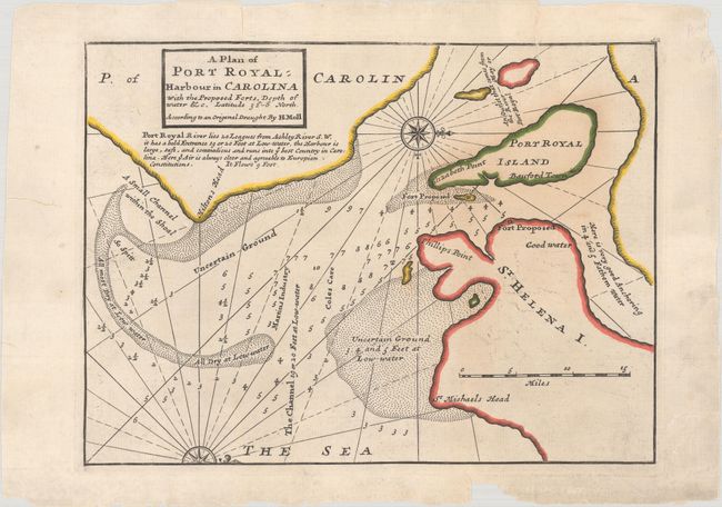
MapMaker: |
Herman Moll
|
|
| |
| |
Subject: |
Port Royal, South Carolina |
|
| |
Period/Size: |
1732 / 7.8" x 10.6" (19.9 x 27.0 cm)
|
|
| |
Color: |
Colored
|
|
| |
Condition: |
(B) A crisp impression with old outline color on a sheet with a fleur-de-lis watermark. There are a few tiny repaired cracks caused by oxidation of green pigment, some minor offsetting, and several repaired edge tears, one of which enters the map image a (condition help) |
|
| |
Source: |
Atlas Minor |
|
| |
References: |
Cumming (SE) #200; Phillips (A) #578-52. |
|
| |
|
|
| Sales Information |
| |
| |
Price: |
|
|
| |
| |
Offered by: |
Old World Auctions |
|
| |
Catalog: |
Auction No. 184 - Antique Maps, Charts, Atlases & Globes (9549) |
|
| |
Lot/Item #: |
334 |
|
| |
| |
Date: |
09/2021
|
|
| |
| |
|