Title:
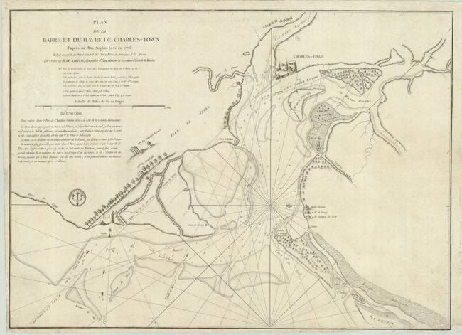
“Plan de la Barre et du Havre de Charles-Town d'apres un Plan Anglois Leve en 1776 Redige en 1778…”
Map Maker:
Antoine de Sartine
This is a French edition of Sayer & Bennett's impo... (full text available to subscribers)
| Item Detail |
| |
| |
MapMaker: |
Antoine de Sartine
|
|
| |
| |
Subject: |
Colonial South Carolina |
|
| |
Period/Size: |
1778 / 16.5" x 23.0" (42.0 x 58.5 cm)
|
|
| |
Color: |
Black & White
|
|
| |
Condition: |
(B) Trimmed close (1/8") at bottom and left with some light surface soil in map. (condition help) |
|
| |
Source: |
|
|
| |
References: |
Sellers & Van Ee #1549. |
|
| |
|
|
| Sales Information |
| |
| |
Price: |
|
|
| |
| |
Offered by: |
Old World Auctions |
|
| |
Catalog: |
Auction No. 119 - Antique Maps, Charts, Atlases & Globes (585) |
|
| |
Lot/Item #: |
343 |
|
| |
| |
Date: |
05/2007
|
|
| |
| |
|
Antique Maps - Valuation and Pricing, Descriptions, Resources |
|
Home |
Information |
Search |
Register |
Contact Us |
Site Map
Americana Exchange, Inc. © 1999 - 2024 Americana Exchange, Inc.. All rights reserved.
OldMaps.com, the OldMaps.com logo and
AMPR are service marks or registered service marks of Americana Exchange, Inc..
|