| Item Detail |
| |
| |
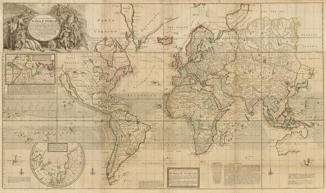
MapMaker: |
Herman Moll
|
|
| |
| |
Subject: |
World |
|
| |
Period/Size: |
1719 / 28.0" x 47.5" (71.2 x 120.7 cm)
|
|
| |
Color: |
Colored
|
|
| |
Condition: |
Original outline color with a few insignificant spots and light toning along some folds. The map has been professionally backed with heavy tissue, repairing a couple 4" tears at bottom and reinforcing fold separations. Overall good condition for such a (condition help) |
|
| |
Source: |
|
|
| |
References: |
Reinhartz plt. #3; Wagner (NW) #512; Phillips (M) p.1089. |
|
| |
|
|
| Sales Information |
| |
| |
Price: |
|
|
| |
| |
Offered by: |
Old World Auctions |
|
| |
Catalog: |
Auction No. 132 - Antique Maps, Charts, Atlases & Globes (7403) |
|
| |
Lot/Item #: |
24 |
|
| |
| |
Date: |
06/2010
|
|
| |
| |
|