|
|
||
Title:
“An Historical Map of the Roman Empire and the neighboring Barbarous Nations to the year of our Lord Four Hundred when the Empire began to be rent with foreign Invasions”
Map Maker:
Herman Moll
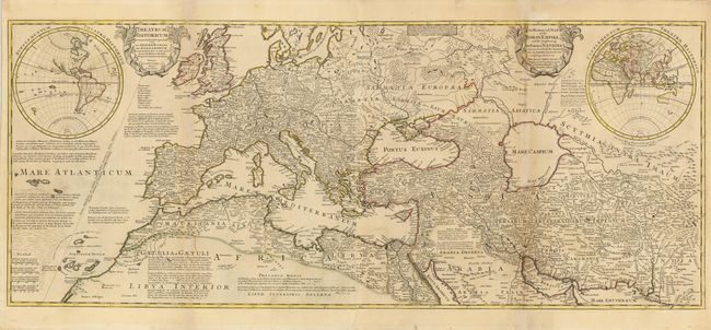
This large-scale map of the Roman Empire in the ye... (full text available to subscribers)
|
|
|||||||||||||||||||||||||||||||||||||||||||||||||||||||||||||||||||||||||||||||||||||||||
Antique Maps - Valuation and Pricing, Descriptions, Resources | ||||||||||||||||||||||||||||||||||||||||||||||||||||||||||||||||||||||||||||||||||||||||||
|
Home |
Information |
Search |
Register |
Contact Us |
Site Map
Americana Exchange, Inc. © 1999 - 2024 Americana Exchange, Inc.. All rights reserved.
OldMaps.com, the OldMaps.com logo and |