Rister or Sign In to see pricing information


Title:

Map of the North West from Explorations by the United States Engineers & Royal Engineers of England and Union & Northern Pacific R.R. Surveys

Map Maker:

Julius Bien

Map of the North West from Explorations by the United States Engineers & Royal Engineers of England and Union & Northern Pacific R.R. Surveys

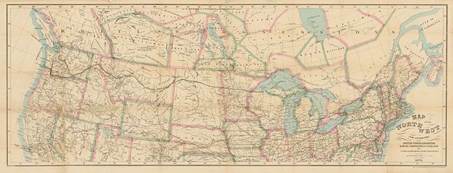
The route of the Northern Pacific Railway from Mic... (full text available to subscribers)
Item Detail
 
  MapMaker:  

Julius Bien


  Subject:  Western Canada & United States  
  Period/Size:  1870 / 15.3" x 41.0"  (38.9 x 104.2 cm)  
  Color:  Colored  
  Condition:  Issued folding, now backed with archival tissue. Backing to support some fold weakness with areas of small loss in Nevada and Utah. (condition help)  
  Source:   
  References:   
 
 
Sales Information
 
  Price: 

Please register your email to view records, or sign in with email address to see records


  Offered by:  Old World Auctions  
  Catalog:  Auction No. 132 - Antique Maps, Charts, Atlases & Globes (7403)  
  Lot/Item #:  125  
 
  Date:  06/2010  


Antique Maps - Valuation and Pricing, Descriptions, Resources


Home | Information | Search | Register | Contact Us | Site Map

Americana Exchange, Inc. © 1999 - 2024 Americana Exchange, Inc.. All rights reserved. OldMaps.com, the OldMaps.com logo and
AMPR are service marks or registered service marks of Americana Exchange, Inc..