Title:
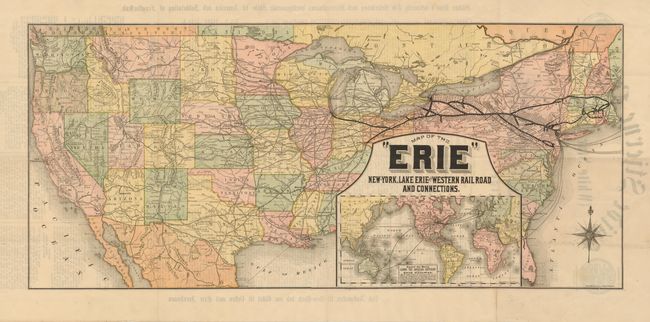
“Map of the "Erie" New York, Lake Erie and Western Railroad and Connections”
Map Maker:
Rand, McNally & Co.
This very scarce folding broadside was published b... (full text available to subscribers)
| Item Detail |
| |
| |
MapMaker: |
Rand, McNally & Co.
|
|
| |
| |
Subject: |
United States - Railroad |
|
| |
Period/Size: |
1882 / 14.0" x 31.5" (35.6 x 80.1 cm)
|
|
| |
Color: |
Colored
|
|
| |
Condition: |
The document is near fine except for four small areas of inset damage with slight loss, two in the lower portion of the map. Folding as issued. (condition help) |
|
| |
Source: |
|
|
| |
References: |
|
|
| |
|
|
| Sales Information |
| |
| |
Price: |
|
|
| |
| |
Offered by: |
Old World Auctions |
|
| |
Catalog: |
Auction No. 132 - Antique Maps, Charts, Atlases & Globes (7403) |
|
| |
Lot/Item #: |
139 |
|
| |
| |
Date: |
06/2010
|
|
| |
| |
|
Antique Maps - Valuation and Pricing, Descriptions, Resources |
|
Home |
Information |
Search |
Register |
Contact Us |
Site Map
Americana Exchange, Inc. © 1999 - 2024 Americana Exchange, Inc.. All rights reserved.
OldMaps.com, the OldMaps.com logo and
AMPR are service marks or registered service marks of Americana Exchange, Inc..
|