Title:
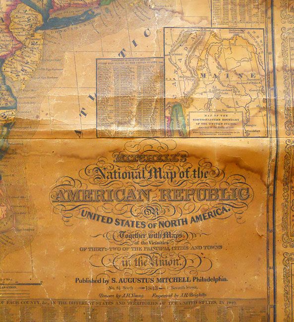
“Mitchell's National Map of the American Republic or United States of North America, Together with Maps of the Vicinities of Thirty-Two of the Principal Cities and Towns in the Union”
Map Maker:
Samuel Augustus Mitchell
This is a very nice wall map that was drawn by J.H... (full text available to subscribers)
| Item Detail |
| |
| |
MapMaker: |
Samuel Augustus Mitchell
|
|
| |
| |
Subject: |
Eastern United States, Texas |
|
| |
Period/Size: |
1843 / 38.0" x 47.0" (96.6 x 119.4 cm)
|
|
| |
Color: |
Colored
|
|
| |
Condition: |
The map is overall very sound. With overall darkening to varnish and water stains across top and one area along right side. Both rollers attached but lower one is partially detached at right. The map surface is very good with just two small pieces miss (condition help) |
|
| |
Source: |
|
|
| |
References: |
|
|
| |
|
|
| Sales Information |
| |
| |
Price: |
|
|
| |
| |
Offered by: |
Old World Auctions |
|
| |
Catalog: |
Auction No. 132 - Antique Maps, Charts, Atlases & Globes (7403) |
|
| |
Lot/Item #: |
152 |
|
| |
| |
Date: |
06/2010
|
|
| |
| |
|
Antique Maps - Valuation and Pricing, Descriptions, Resources |
|
Home |
Information |
Search |
Register |
Contact Us |
Site Map
Americana Exchange, Inc. © 1999 - 2024 Americana Exchange, Inc.. All rights reserved.
OldMaps.com, the OldMaps.com logo and
AMPR are service marks or registered service marks of Americana Exchange, Inc..
|