Title:
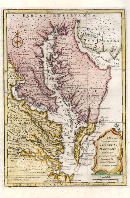
“A New and Accurate Map of Virginia & Maryland, Laid Down from Surveys and Regulated by Astronl. Observatns.”
Map Maker:
Emanuel Bowen
This uncommon map centered of the Chesapeake Bay r... (full text available to subscribers)
| Item Detail |
| |
| |
MapMaker: |
Emanuel Bowen
|
|
| |
| |
Subject: |
Colonial Mid-Atlantic |
|
| |
Period/Size: |
1757 / 12.8" x 9.0" (32.6 x 22.9 cm)
|
|
| |
Color: |
Colored
|
|
| |
Condition: |
(condition help) |
|
| |
Source: |
A Complete System of Geography |
|
| |
References: |
Papenfuse & Coale plt. 24. |
|
| |
|
|
| Sales Information |
| |
| |
Price: |
|
|
| |
| |
Offered by: |
Old World Auctions |
|
| |
Catalog: |
Auction No. 132 - Antique Maps, Charts, Atlases & Globes (7403) |
|
| |
Lot/Item #: |
167 |
|
| |
| |
Date: |
06/2010
|
|
| |
| |
|
Antique Maps - Valuation and Pricing, Descriptions, Resources |
|
Home |
Information |
Search |
Register |
Contact Us |
Site Map
Americana Exchange, Inc. © 1999 - 2024 Americana Exchange, Inc.. All rights reserved.
OldMaps.com, the OldMaps.com logo and
AMPR are service marks or registered service marks of Americana Exchange, Inc..
|