Title:
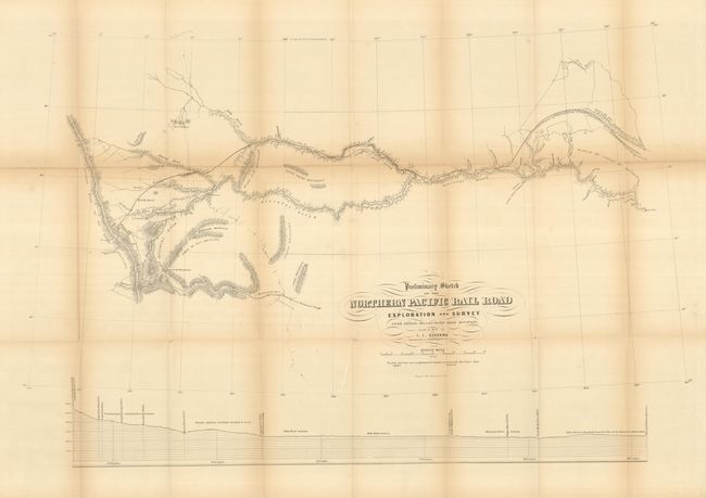
“Preliminary Sketch of the Northern Pacific Rail Road Exploration and Survey from Riviere des Lacs to the Rocky Mountains Made in 1853”
Map Maker:
Isaac Ingalls Stevens
This map details the Stevens surveys beginning on ... (full text available to subscribers)
| Item Detail |
| |
| |
MapMaker: |
Isaac Ingalls Stevens
|
|
| |
| |
Subject: |
Northwestern United States |
|
| |
Period/Size: |
1855 / 21.5" x 32.5" (54.7 x 82.6 cm)
|
|
| |
Color: |
Black & White
|
|
| |
Condition: |
The map is generally sound but there is a long fold split along the upper horizontal fold and the folds are toned. The map should be professionally backed to stabilize the paper. (condition help) |
|
| |
Source: |
U.S. Pacific Railroad Surveys |
|
| |
References: |
Wheat (TMW) #862. |
|
| |
|
|
| Sales Information |
| |
| |
Price: |
|
|
| |
| |
Offered by: |
Old World Auctions |
|
| |
Catalog: |
Auction No. 132 - Antique Maps, Charts, Atlases & Globes (7403) |
|
| |
Lot/Item #: |
207 |
|
| |
| |
Date: |
06/2010
|
|
| |
| |
|
Antique Maps - Valuation and Pricing, Descriptions, Resources |
|
Home |
Information |
Search |
Register |
Contact Us |
Site Map
Americana Exchange, Inc. © 1999 - 2024 Americana Exchange, Inc.. All rights reserved.
OldMaps.com, the OldMaps.com logo and
AMPR are service marks or registered service marks of Americana Exchange, Inc..
|