Title:
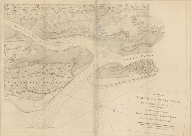
“A Plan of the Harbour of St. Augustin in the Province of Georgia Composed & Published from Surveys…”
Map Maker:
Joseph Frederick Wallet Des Barres
This finely drafted map features the harbor and to... (full text available to subscribers)
| Item Detail |
| |
| |
MapMaker: |
Joseph Frederick Wallet Des Barres
|
|
| |
| |
Subject: |
St. Augustine, Florida |
|
| |
Period/Size: |
1780 / 27.5" x 39.3" (69.9 x 99.9 cm)
|
|
| |
Color: |
Black & White
|
|
| |
Condition: |
Toned with some lifting along the joint at center. There are two extraneous vertical folds. (condition help) |
|
| |
Source: |
The Atlantic Neptune |
|
| |
References: |
Sellers & van Ee #1643. |
|
| |
|
|
| Sales Information |
| |
| |
Price: |
|
|
| |
| |
Offered by: |
Old World Auctions |
|
| |
Catalog: |
Auction No. 132 - Antique Maps, Charts, Atlases & Globes (7403) |
|
| |
Lot/Item #: |
239 |
|
| |
| |
Date: |
06/2010
|
|
| |
| |
|
Antique Maps - Valuation and Pricing, Descriptions, Resources |
|
Home |
Information |
Search |
Register |
Contact Us |
Site Map
Americana Exchange, Inc. © 1999 - 2024 Americana Exchange, Inc.. All rights reserved.
OldMaps.com, the OldMaps.com logo and
AMPR are service marks or registered service marks of Americana Exchange, Inc..
|