| Item Detail |
| |
| |
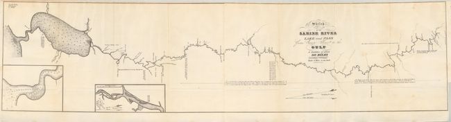
MapMaker: |
J.H. Eaton
|
|
| |
| |
Subject: |
Republic of Texas |
|
| |
Period/Size: |
1838 / 8.4" x 34.5" (21.4 x 87.7 cm)
|
|
| |
Color: |
Black & White
|
|
| |
Condition: |
The folding map has a few very light spots, still very good. The report pages are loose and have light ink offsetting (B+). (condition help) |
|
| |
Source: |
HR Doc. #365, 25th Cong., 2nd Session |
|
| |
References: |
Clausen & Friis #243; Koepp #I-34-1-4. |
|
| |
|
|
| Sales Information |
| |
| |
Price: |
|
|
| |
| |
Offered by: |
Old World Auctions |
|
| |
Catalog: |
Auction No. 132 - Antique Maps, Charts, Atlases & Globes (7403) |
|
| |
Lot/Item #: |
293 |
|
| |
| |
Date: |
06/2010
|
|
| |
| |
|