Title:
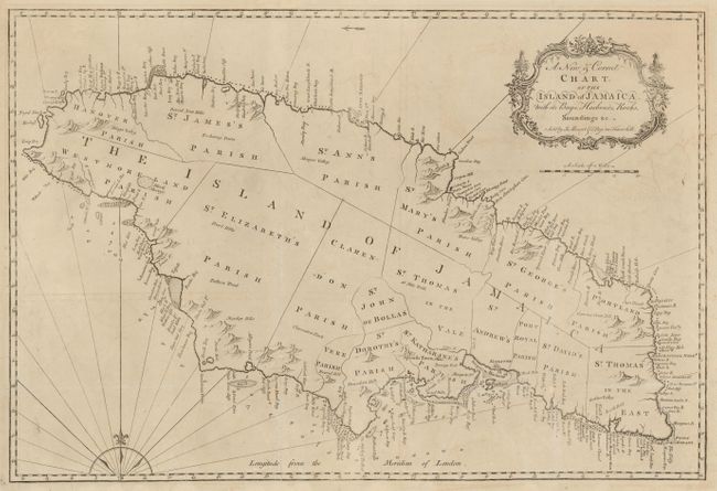
“A New & Correct Chart of the Island of Jamaica with its Bays, Harbours, Rocks, Soundings &c.”
Map Maker:
Mount & Page
This finely engraved map of Jamaica is primarily f... (full text available to subscribers)
| Item Detail |
| |
| |
MapMaker: |
Mount & Page
|
|
| |
| |
Subject: |
Jamaica |
|
| |
Period/Size: |
1770 / 18.0" x 27.0" (45.8 x 68.6 cm)
|
|
| |
Color: |
Black & White
|
|
| |
Condition: |
Issued folded, now flattened with folds and fold intersection damage professionally repaired with a few letters on place names affected. There is some minor offsetting and faint damp stains. (condition help) |
|
| |
Source: |
The English Pilot |
|
| |
References: |
Sellers & Van Ee #1922. |
|
| |
|
|
| Sales Information |
| |
| |
Price: |
|
|
| |
| |
Offered by: |
Old World Auctions |
|
| |
Catalog: |
Auction No. 132 - Antique Maps, Charts, Atlases & Globes (7403) |
|
| |
Lot/Item #: |
348 |
|
| |
| |
Date: |
06/2010
|
|
| |
| |
|
Antique Maps - Valuation and Pricing, Descriptions, Resources |
|
Home |
Information |
Search |
Register |
Contact Us |
Site Map
Americana Exchange, Inc. © 1999 - 2024 Americana Exchange, Inc.. All rights reserved.
OldMaps.com, the OldMaps.com logo and
AMPR are service marks or registered service marks of Americana Exchange, Inc..
|