Title:
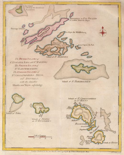
“The Dutch Islands of St. Eustatia, Saba, and St. Martins; The French Island of St. Bartholomew; The English Islands of St. Christophers, Nevis, and Anguilla; with the smaller Islands and Keys adjoining”
Map Maker:
John Lodge
This uncommon map of the Leeward Islands shows the... (full text available to subscribers)
| Item Detail |
| |
| |
MapMaker: |
John Lodge
|
|
| |
| |
Subject: |
Lesser Antilles |
|
| |
Period/Size: |
1781 / 10.5" x 8.3" (26.7 x 21.1 cm)
|
|
| |
Color: |
Colored
|
|
| |
Condition: |
Issued folded, now flattened with the left margin and part of the lower right side margin added to accommodate framing. A tiny binding tear at lower right has been repaired. (condition help) |
|
| |
Source: |
Political Magazine |
|
| |
References: |
Jolly POL-21. |
|
| |
|
|
| Sales Information |
| |
| |
Price: |
|
|
| |
| |
Offered by: |
Old World Auctions |
|
| |
Catalog: |
Auction No. 132 - Antique Maps, Charts, Atlases & Globes (7403) |
|
| |
Lot/Item #: |
357 |
|
| |
| |
Date: |
06/2010
|
|
| |
| |
|
Antique Maps - Valuation and Pricing, Descriptions, Resources |
|
Home |
Information |
Search |
Register |
Contact Us |
Site Map
Americana Exchange, Inc. © 1999 - 2024 Americana Exchange, Inc.. All rights reserved.
OldMaps.com, the OldMaps.com logo and
AMPR are service marks or registered service marks of Americana Exchange, Inc..
|