Title:
“Provincie Dello Spirito Santo e di Porto Sicuro”
Map Maker:
Andreas Antonius Horatius
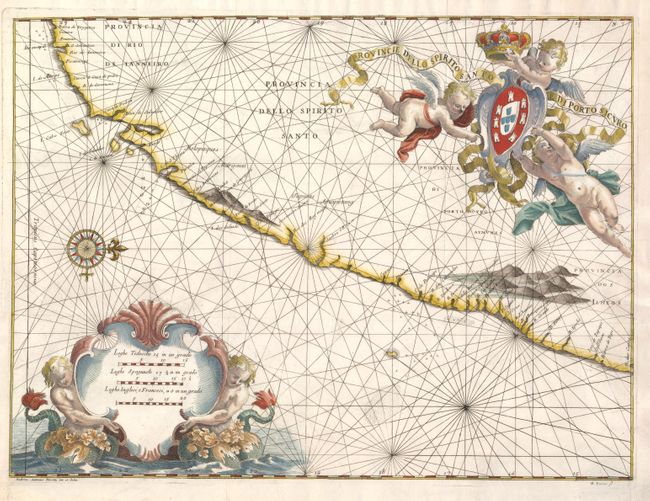
This striking map covers the coast from Rio de Jan... (full text available to subscribers)
| Item Detail |
| |
| |
MapMaker: |
Andreas Antonius Horatius
|
|
| |
| |
Subject: |
Brazil |
|
| |
Period/Size: |
1698 / 14.6" x 19.8" (37.1 x 50.3 cm)
|
|
| |
Color: |
Colored
|
|
| |
Condition: |
Issued folded with some tissue reinforcement on folds. (condition help) |
|
| |
Source: |
Istoria delle Guerre del Regno del Brasile |
|
| |
References: |
|
|
| |
|
|
| Sales Information |
| |
| |
Price: |
|
|
| |
| |
Offered by: |
Old World Auctions |
|
| |
Catalog: |
Auction No. 132 - Antique Maps, Charts, Atlases & Globes (7403) |
|
| |
Lot/Item #: |
379 |
|
| |
| |
Date: |
06/2010
|
|
| |
| |
|
Antique Maps - Valuation and Pricing, Descriptions, Resources |
|
Home |
Information |
Search |
Register |
Contact Us |
Site Map
Americana Exchange, Inc. © 1999 - 2024 Americana Exchange, Inc.. All rights reserved.
OldMaps.com, the OldMaps.com logo and
AMPR are service marks or registered service marks of Americana Exchange, Inc..
|