Title:
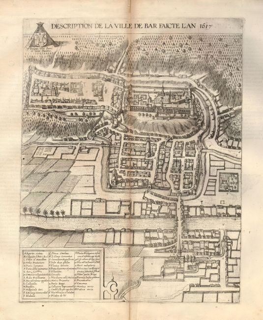
“Description de la Ville de Bar Faicte l'An 1617”
Map Maker:
Braun & Hogenberg
Lovely, bird's-eye city plan of Bar-le-Duc, locate... (full text available to subscribers)
| Item Detail |
| |
| |
MapMaker: |
Braun & Hogenberg
|
|
| |
| |
Subject: |
France |
|
| |
Period/Size: |
1617 / 17.3" x 13.5" (44.0 x 34.3 cm)
|
|
| |
Color: |
Black & White
|
|
| |
Condition: |
A sharp impression with wide original margins. The centerfold is toned and has an old repair on verso. (condition help) |
|
| |
Source: |
Civitates Orbis Terrarum |
|
| |
References: |
Fussel pp. 446-447. |
|
| |
|
|
| Sales Information |
| |
| |
Price: |
|
|
| |
| |
Offered by: |
Old World Auctions |
|
| |
Catalog: |
Auction No. 132 - Antique Maps, Charts, Atlases & Globes (7403) |
|
| |
Lot/Item #: |
466 |
|
| |
| |
Date: |
06/2010
|
|
| |
| |
|
Antique Maps - Valuation and Pricing, Descriptions, Resources |
|
Home |
Information |
Search |
Register |
Contact Us |
Site Map
Americana Exchange, Inc. © 1999 - 2024 Americana Exchange, Inc.. All rights reserved.
OldMaps.com, the OldMaps.com logo and
AMPR are service marks or registered service marks of Americana Exchange, Inc..
|