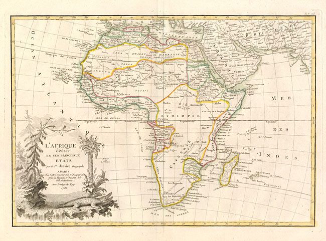
Title:
“L'Afrique divisee en ses Principaux Etats”
Map Maker:
Janvier/Lattre
Excellent copper engraved map of the continent sho... (full text available to subscribers)
| Item Detail |
| |
| |
MapMaker: |
Janvier/Lattre
|
|
| |
| |
Subject: |
Africa |
|
| |
Period/Size: |
1782 / 11.8" x 17.2" (30.0 x 43.7 cm)
|
|
| |
Color: |
Colored
|
|
| |
Condition: |
On thick paper with very wide margins. With a large and elaborate watermark that bears the date "1782" matching the date of publication. (condition help) |
|
| |
Source: |
Atlas Moderne |
|
| |
References: |
Norwich #104. |
|
| |
|
|
| Sales Information |
| |
| |
Price: |
|
|
| |
| |
Offered by: |
Old World Auctions |
|
| |
Catalog: |
Auction No. 132 - Antique Maps, Charts, Atlases & Globes (7403) |
|
| |
Lot/Item #: |
655 |
|
| |
| |
Date: |
06/2010
|
|
| |
| |
|
Antique Maps - Valuation and Pricing, Descriptions, Resources |
|
Home |
Information |
Search |
Register |
Contact Us |
Site Map
Americana Exchange, Inc. © 1999 - 2024 Americana Exchange, Inc.. All rights reserved.
OldMaps.com, the OldMaps.com logo and
AMPR are service marks or registered service marks of Americana Exchange, Inc..
|