Title:
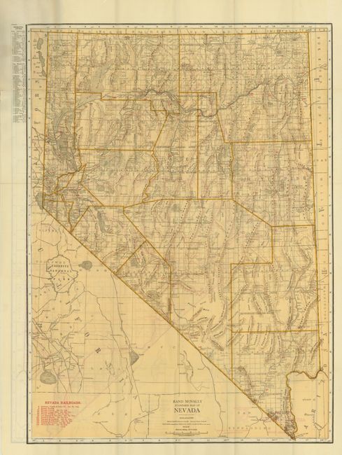
“Nevada Rand McNally Indexed Pocket Map Tourists' and Shippers' Guide Main Highways Railraods and Electric Lines Counties, Cities, Towns, Villages…”
Map Maker:
Rand, McNally & Co.
This is a fine pocket map of the state that is bea... (full text available to subscribers)
| Item Detail |
| |
| |
MapMaker: |
Rand, McNally & Co.
|
|
| |
| |
Subject: |
Nevada |
|
| |
Period/Size: |
1920 / 25.8" x 18.6" (65.6 x 47.3 cm)
|
|
| |
Color: |
Colored
|
|
| |
Condition: |
The map is the cleanest and brightest example we've seen from this series, unfortunately it has some small fold intersection splits with one being a 1/2" puncture with no loss. The boards are also fine except the upper tip is missing on front and two lar (condition help) |
|
| |
Source: |
|
|
| |
References: |
|
|
| |
|
|
| Sales Information |
| |
| |
Price: |
|
|
| |
| |
Offered by: |
Old World Auctions |
|
| |
Catalog: |
Auction No. 133 - Antique Maps, Charts, Atlases & Globes (7404) |
|
| |
Lot/Item #: |
257 |
|
| |
| |
Date: |
09/2010
|
|
| |
| |
|
Antique Maps - Valuation and Pricing, Descriptions, Resources |
|
Home |
Information |
Search |
Register |
Contact Us |
Site Map
Americana Exchange, Inc. © 1999 - 2024 Americana Exchange, Inc.. All rights reserved.
OldMaps.com, the OldMaps.com logo and
AMPR are service marks or registered service marks of Americana Exchange, Inc..
|