Title:
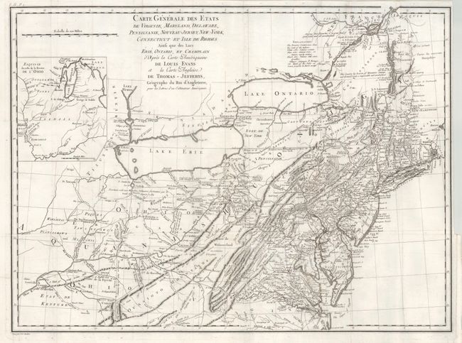
“Carte Generale des Etats de Virginie, Maryland, Delaware, Pensilvanie, Nouveau-Jersey, New-York, Connecticut et Isle de Rhodes Ainsi que des Lacs Erie, Ontario, et Champlain…”
Map Maker:
Michel Guillaume St. Jean de Crevecoeur
This is an updated French edition of Evans' rare a... (full text available to subscribers)
| Item Detail |
| |
| |
MapMaker: |
Michel Guillaume St. Jean de Crevecoeur
|
|
| |
| |
Subject: |
Eastern United States |
|
| |
Period/Size: |
1787 / 18.8" x 25.5" (47.8 x 64.8 cm)
|
|
| |
Color: |
Black & White
|
|
| |
Condition: |
Folding as issued with the normal close binding trim at right. (condition help) |
|
| |
Source: |
Lettres d'un Cultivateur Americain |
|
| |
References: |
McCorkle #787.6; cf Schwartz/Ehrenberg, p.162, pl. 98. |
|
| |
|
|
| Sales Information |
| |
| |
Price: |
|
|
| |
| |
Offered by: |
Old World Auctions |
|
| |
Catalog: |
Auction No. 133 - Antique Maps, Charts, Atlases & Globes (7404) |
|
| |
Lot/Item #: |
135 |
|
| |
| |
Date: |
09/2010
|
|
| |
| |
|
Antique Maps - Valuation and Pricing, Descriptions, Resources |
|
Home |
Information |
Search |
Register |
Contact Us |
Site Map
Americana Exchange, Inc. © 1999 - 2024 Americana Exchange, Inc.. All rights reserved.
OldMaps.com, the OldMaps.com logo and
AMPR are service marks or registered service marks of Americana Exchange, Inc..
|