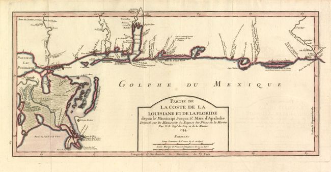
Title:
“Partie de la Coste de la Louisiane et de La Floride depuis le Missisippi Jusqua St. Marc d'Apalache”
Map Maker:
Jacques Nicolas Bellin
This important early chart of the Gulf Coast cover... (full text available to subscribers)
| Item Detail |
| |
| |
MapMaker: |
Jacques Nicolas Bellin
|
|
| |
| |
Subject: |
Colonial South |
|
| |
Period/Size: |
1744 / 8.3" x 16.8" (21.1 x 42.7 cm)
|
|
| |
Color: |
Colored
|
|
| |
Condition: |
Despite some very faint offsetting, overall very good with a sharp impression and wide original margins. (condition help) |
|
| |
Source: |
Charlevoix's Histoire et description generale de la Nouvelle France |
|
| |
References: |
Tooley (MCC-96) #719. |
|
| |
|
|
| Sales Information |
| |
| |
Price: |
|
|
| |
| |
Offered by: |
Old World Auctions |
|
| |
Catalog: |
Auction No. 133 - Antique Maps, Charts, Atlases & Globes (7404) |
|
| |
Lot/Item #: |
168 |
|
| |
| |
Date: |
09/2010
|
|
| |
| |
|
Antique Maps - Valuation and Pricing, Descriptions, Resources |
|
Home |
Information |
Search |
Register |
Contact Us |
Site Map
Americana Exchange, Inc. © 1999 - 2024 Americana Exchange, Inc.. All rights reserved.
OldMaps.com, the OldMaps.com logo and
AMPR are service marks or registered service marks of Americana Exchange, Inc..
|