| Item Detail |
| |
| |
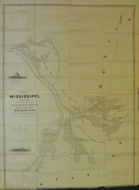
MapMaker: |
William James Stone
|
|
| |
| |
Subject: |
Louisiana |
|
| |
Period/Size: |
1840 / 42.0" x 30.0" (106.7 x 76.2 cm)
|
|
| |
Color: |
Black & White
|
|
| |
Condition: |
The map is in extraordinary condition for a folding map of this size. Clean and bright with no flaws save for a very small piece of the paper at lower neatline is attached to binding, torn off when map was first opened. The disbound report is very good. (condition help) |
|
| |
Source: |
No. 463, 26th Congress, 1st Session. |
|
| |
References: |
Claussen & Friis #358 |
|
| |
|
|
| Sales Information |
| |
| |
Price: |
|
|
| |
| |
Offered by: |
Old World Auctions |
|
| |
Catalog: |
Auction No. 133 - Antique Maps, Charts, Atlases & Globes (7404) |
|
| |
Lot/Item #: |
246 |
|
| |
| |
Date: |
09/2010
|
|
| |
| |
|