Title:
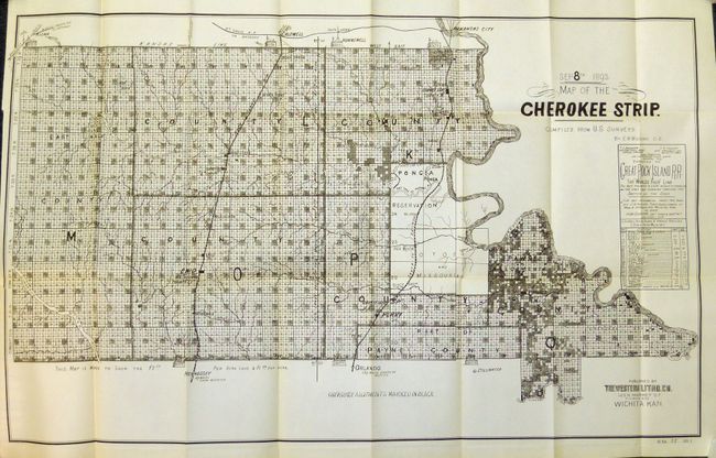
“Map of the Cherokee Strip Compiled from U.S. Surveys by E.W. Wiggins, C.E.”
Map Maker:
U.S. War Department
The Cherokee Outlet, about 12,000 square miles in ... (full text available to subscribers)
| Item Detail |
| |
| |
MapMaker: |
U.S. War Department
|
|
| |
| |
Subject: |
Oklahoma |
|
| |
Period/Size: |
1893 / 19.8" x 32.3" (50.3 x 82.1 cm)
|
|
| |
Color: |
Black & White
|
|
| |
Condition: |
The condition of the report and map is exquisite, flawless. It is remarkable that a government report and folding map exists in this condition after nearly 120 years. (condition help) |
|
| |
Source: |
HR Doc 27, 53rd Cong. 1st Sess. |
|
| |
References: |
|
|
| |
|
|
| Sales Information |
| |
| |
Price: |
|
|
| |
| |
Offered by: |
Old World Auctions |
|
| |
Catalog: |
Auction No. 133 - Antique Maps, Charts, Atlases & Globes (7404) |
|
| |
Lot/Item #: |
271 |
|
| |
| |
Date: |
09/2010
|
|
| |
| |
|
Antique Maps - Valuation and Pricing, Descriptions, Resources |
|
Home |
Information |
Search |
Register |
Contact Us |
Site Map
Americana Exchange, Inc. © 1999 - 2024 Americana Exchange, Inc.. All rights reserved.
OldMaps.com, the OldMaps.com logo and
AMPR are service marks or registered service marks of Americana Exchange, Inc..
|