| Item Detail |
| |
| |
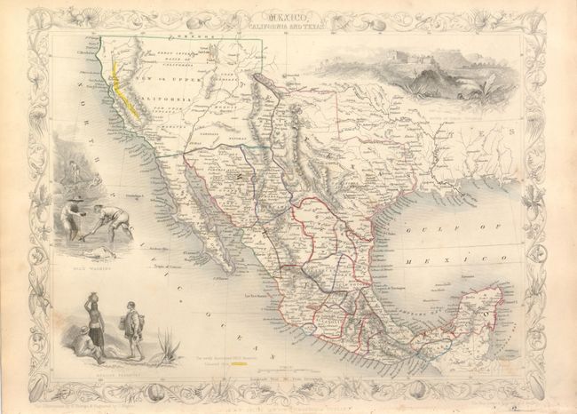
MapMaker: |
John Tallis
|
|
| |
| |
Subject: |
Western United States & Mexico |
|
| |
Period/Size: |
1850 / 10.0" x 13.0" (25.4 x 33.1 cm)
|
|
| |
Color: |
Colored
|
|
| |
Condition: |
Good margins (which is often a problem with this map) and original outline color. There is some unobtrusive surface soil, still overall very good. (condition help) |
|
| |
Source: |
Illustrated Atlas and Modern History of the World |
|
| |
References: |
Wheat (TMW) #694. |
|
| |
|
|
| Sales Information |
| |
| |
Price: |
|
|
| |
| |
Offered by: |
Old World Auctions |
|
| |
Catalog: |
Auction No. 133 - Antique Maps, Charts, Atlases & Globes (7404) |
|
| |
Lot/Item #: |
296 |
|
| |
| |
Date: |
09/2010
|
|
| |
| |
|