Title:
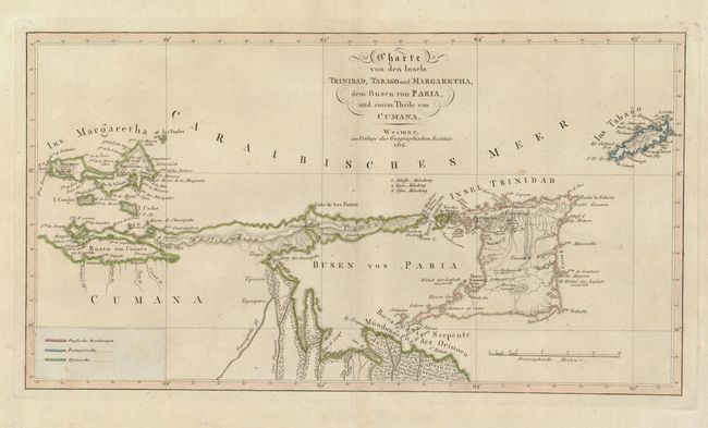
“Charte von den Inseln Trinidad, Tabago und Margaretha, dem Busen von Paria, und einem Theile von Cumana”
Map Maker:
Weimar Geographisches Institut
This interesting chart covers from the Margarita I... (full text available to subscribers)
| Item Detail |
| |
| |
MapMaker: |
Weimar Geographisches Institut
|
|
| |
| |
Subject: |
Trinidad & Tobago |
|
| |
Period/Size: |
1814 / 8.8" x 16.0" (22.4 x 40.7 cm)
|
|
| |
Color: |
Colored
|
|
| |
Condition: |
Original outline color with wide original margins. There are a few minor spots, else very good. (condition help) |
|
| |
Source: |
|
|
| |
References: |
|
|
| |
|
|
| Sales Information |
| |
| |
Price: |
|
|
| |
| |
Offered by: |
Old World Auctions |
|
| |
Catalog: |
Auction No. 133 - Antique Maps, Charts, Atlases & Globes (7404) |
|
| |
Lot/Item #: |
334 |
|
| |
| |
Date: |
09/2010
|
|
| |
| |
|
Antique Maps - Valuation and Pricing, Descriptions, Resources |
|
Home |
Information |
Search |
Register |
Contact Us |
Site Map
Americana Exchange, Inc. © 1999 - 2024 Americana Exchange, Inc.. All rights reserved.
OldMaps.com, the OldMaps.com logo and
AMPR are service marks or registered service marks of Americana Exchange, Inc..
|