Title:
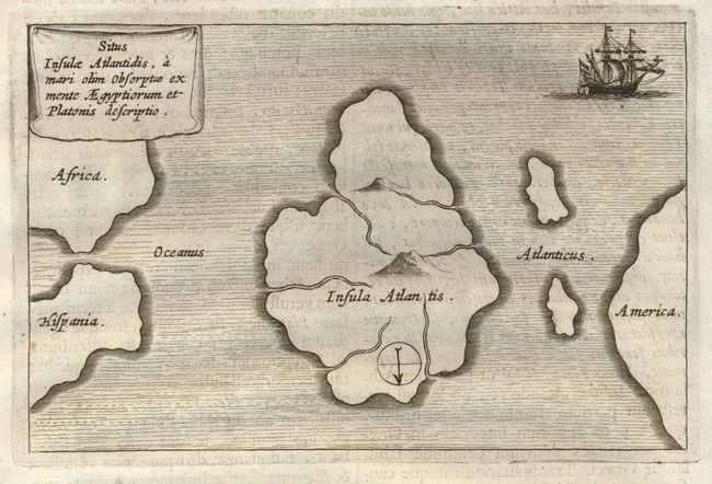
“Situs Insulae Atlantidis, a Mari olim absorptae ex mente Aegyptiorum et Platonis descriptio”
Map Maker:
Athanasius Kircher
This mythical map of Atlantis is printed wi... (full text available to subscribers)
| Item Detail |
| |
| |
MapMaker: |
Athanasius Kircher
|
|
| |
| |
Subject: |
Atlantic Ocean - Atlantis |
|
| |
Period/Size: |
1678 / 4.0" x 6.3" (10.2 x 16.0 cm)
|
|
| |
Color: |
Black & White
|
|
| |
Condition: |
The map image is very good. The full text sheet has a water stain along top edge, well away from the map image (B+). (condition help) |
|
| |
Source: |
Mundus Subterraneus |
|
| |
References: |
|
|
| |
|
|
| Sales Information |
| |
| |
Price: |
|
|
| |
| |
Offered by: |
Old World Auctions |
|
| |
Catalog: |
Auction No. 133 - Antique Maps, Charts, Atlases & Globes (7404) |
|
| |
Lot/Item #: |
360 |
|
| |
| |
Date: |
09/2010
|
|
| |
| |
|
Antique Maps - Valuation and Pricing, Descriptions, Resources |
|
Home |
Information |
Search |
Register |
Contact Us |
Site Map
Americana Exchange, Inc. © 1999 - 2024 Americana Exchange, Inc.. All rights reserved.
OldMaps.com, the OldMaps.com logo and
AMPR are service marks or registered service marks of Americana Exchange, Inc..
|