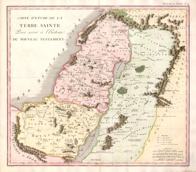
Title:
“Carte d'Etude de la Terre Sainte Pour servir a l'Histoire du Nouveau Testament”
Map Maker:
Pierre Mortier
This is an uncommon version of Mortier's map of th... (full text available to subscribers)
| Item Detail |
| |
| |
MapMaker: |
Pierre Mortier
|
|
| |
| |
Subject: |
Holy Land |
|
| |
Period/Size: |
1809 / 15.2" x 17.3" (38.6 x 44.0 cm)
|
|
| |
Color: |
Colored
|
|
| |
Condition: |
Minor soil in margins. (condition help) |
|
| |
Source: |
Nouvel atlas de la Bible… |
|
| |
References: |
|
|
| |
|
|
| Sales Information |
| |
| |
Price: |
|
|
| |
| |
Offered by: |
Old World Auctions |
|
| |
Catalog: |
Auction No. 133 - Antique Maps, Charts, Atlases & Globes (7404) |
|
| |
Lot/Item #: |
579 |
|
| |
| |
Date: |
09/2010
|
|
| |
| |
|
Antique Maps - Valuation and Pricing, Descriptions, Resources |
|
Home |
Information |
Search |
Register |
Contact Us |
Site Map
Americana Exchange, Inc. © 1999 - 2024 Americana Exchange, Inc.. All rights reserved.
OldMaps.com, the OldMaps.com logo and
AMPR are service marks or registered service marks of Americana Exchange, Inc..
|