Title:
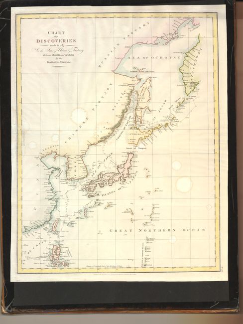
“Chart of Discoveries made in 1787 In the Seas of China & Tartary Between Manilla and Avatcha By the Boussole & Astrolabe”
Map Maker:
Jean Francois Galaup de La Perouse
This English version of La Perouse's chart was eng... (full text available to subscribers)
| Item Detail |
| |
| |
MapMaker: |
Jean Francois Galaup de La Perouse
|
|
| |
| |
Subject: |
Eastern Asia |
|
| |
Period/Size: |
1798 / 19.3" x 15.0" (49.1 x 38.1 cm)
|
|
| |
Color: |
Colored
|
|
| |
Condition: |
Faint damp stains and extraneous creasing along the centerfold with some paper restoration and facsimile of the neatline in the left margin. (condition help) |
|
| |
Source: |
|
|
| |
References: |
|
|
| |
|
|
| Sales Information |
| |
| |
Price: |
|
|
| |
| |
Offered by: |
Old World Auctions |
|
| |
Catalog: |
Auction No. 133 - Antique Maps, Charts, Atlases & Globes (7404) |
|
| |
Lot/Item #: |
605 |
|
| |
| |
Date: |
09/2010
|
|
| |
| |
|
Antique Maps - Valuation and Pricing, Descriptions, Resources |
|
Home |
Information |
Search |
Register |
Contact Us |
Site Map
Americana Exchange, Inc. © 1999 - 2024 Americana Exchange, Inc.. All rights reserved.
OldMaps.com, the OldMaps.com logo and
AMPR are service marks or registered service marks of Americana Exchange, Inc..
|