Title:
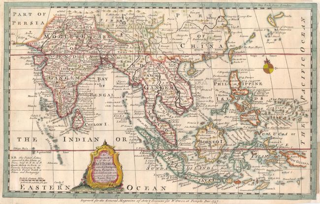
“An Accurate Map of the East Indies, in which ye European forts, Factories, and Settlements are Inserted & distinguished”
Map Maker:
Emanuel Bowen
This little map provides good detail of the region... (full text available to subscribers)
| Item Detail |
| |
| |
MapMaker: |
Emanuel Bowen
|
|
| |
| |
Subject: |
Southeast Asia |
|
| |
Period/Size: |
1757 / 7.2" x 11.4" (18.3 x 29.0 cm)
|
|
| |
Color: |
Colored
|
|
| |
Condition: |
Lightly toned with some professional paper restoration in the margins. (condition help) |
|
| |
Source: |
General Magazine of Arts & Sciences |
|
| |
References: |
Jolly GENMAS-79. |
|
| |
|
|
| Sales Information |
| |
| |
Price: |
|
|
| |
| |
Offered by: |
Old World Auctions |
|
| |
Catalog: |
Auction No. 133 - Antique Maps, Charts, Atlases & Globes (7404) |
|
| |
Lot/Item #: |
642 |
|
| |
| |
Date: |
09/2010
|
|
| |
| |
|
Antique Maps - Valuation and Pricing, Descriptions, Resources |
|
Home |
Information |
Search |
Register |
Contact Us |
Site Map
Americana Exchange, Inc. © 1999 - 2024 Americana Exchange, Inc.. All rights reserved.
OldMaps.com, the OldMaps.com logo and
AMPR are service marks or registered service marks of Americana Exchange, Inc..
|